By: Ben Stookesberry
Location: Northern California, Lower Klamath Drainage
Class: V+ ( Crux gorge includes mandatory vertical-walled sections and an unscoutable, unportagable class V+ waterfall )
Gradient: Up to 400 fpm
Flow: 200 – 400 cfs estimate
Nature: Exploratory ( Remote, Isolated Put-in )
Torture Factor: Medium ( I FIXED THIS LINK, IT WASN'T WORKING ON THE LAST COUPLE OF TR'S .. jason )
Ever since my first trip to the Lower Klamath area of the Scott River, Clear Creek, and the California Salmon in the spring of 2000, Dillon Creek has ended every conversation about class V+ in the Lower Klamath.
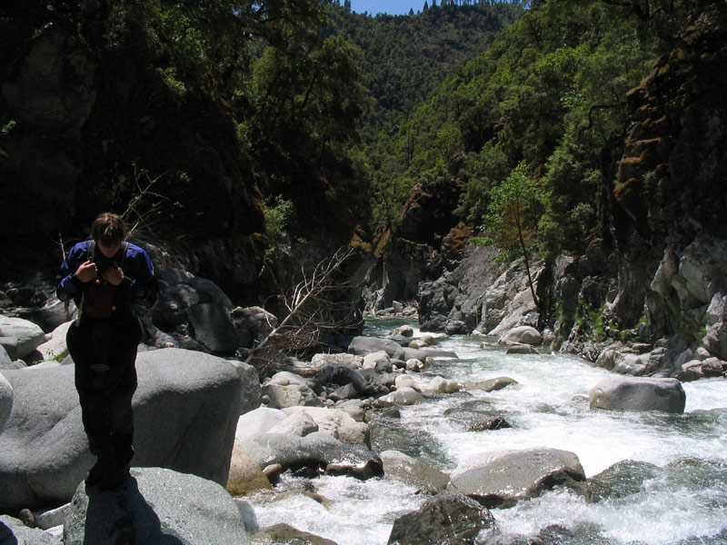
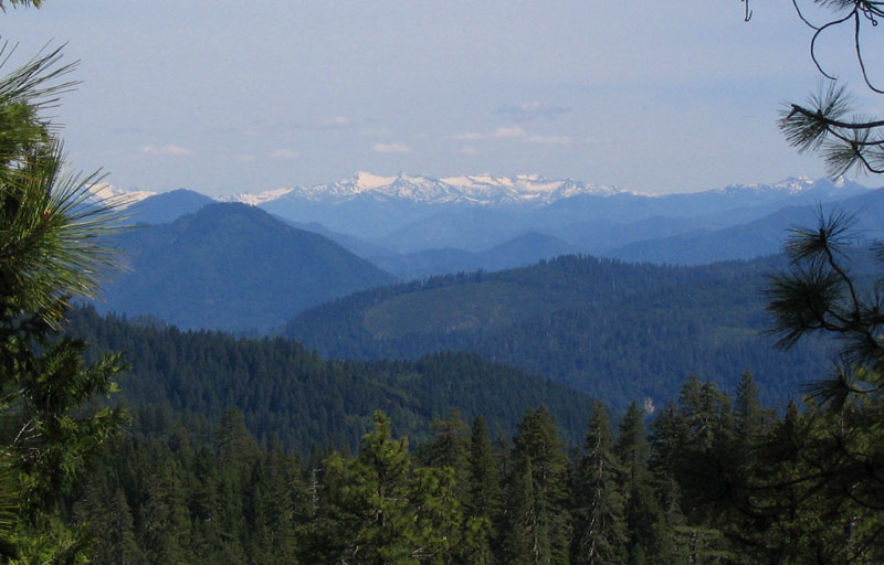
The view from the road to the put in for Dillon Creek.
This years Memorial weekend campfire on the Cal Salmon was once again populated by the usual cast of big hitters and big talkers a.k.a. Judd Lehman, Josh and Tim of the Ashland swim team, James Bagley Jr. and EJ Etherington, Devin Knight, and Chris Korbulic, to name a only a few.
After the obligatory Bridge Creek run, most of the group emerged exhausted and/or otherwise obligated with respect to my Dillon Creek prodding. Judd was quick to remind the group that such talk was the hallmark of his old friend whose six previous opportunities to run Dillon had yielded little more than “a couple of trips to the take out bridge followed by pizza and beer in Happy Camp.”
Judd then recounted a few of the Knapps’ semi-vague observations from their three descents of the Dillon Gorge:
1. At least one boater on each trip received the proverbial "beat down" resulting in a swim at the base of an unscoutable, unportagable, marginally runnable falls deep in the heart of the gorge.
Undaunted by Judd’s ominous remarks, Chris Korbulic said he was in, and Judd was ecstatic.
After many years of blaming Judd for “sand begging” my would-be attempts on Dillon, it appeared as though I might actually be forced into this death trap by the quiet, up and coming Corvallis huckster.
I came up with every excuse in the book to put it off for another two days, but by Tuesday Chris was fed up and called my bluff. I gave into my own foolish pride, and agreed to give the infamous Dillon Gorge a shot..
If the scare factor of the Knapps’ beta surrounding Dillon isn’t enough to keep you away, there is a 20-mile stretch of seasonally maintained randomly marked dirt road that guards the put-in. With the road climbing precipitously from 800 feet to nearly 5000 feet within the first five miles, many attempts have been foiled by snow drifts, washouts, rock falls, down trees, etc. Unfortunately there would be no such road blocks this year.
The road was clear all the way up fifteen miles to a forest service gate where five more miles of easy hiking led to the put-in near the top of the water shed at the old Siskon Mine site on Copper Creek.
The flow in Copper Creek was just barely enough to float us, and I was relieved. I was banking on this low flow to allow for some scouting and portaging in the heart of The Gorge. No more than a mile in, Copper Creek turned to bedrock and the seemingly paltry flow filled nicely into the granite slides with gorge walls growing on either side.
Soon we encountered a particularly tight rapid dropping about twenty feet that Chris quickly ran without consequence, then he disappeared around a walled in corner and hooted excitedly.
Chris Korbulic probes the tight twenty-footer.
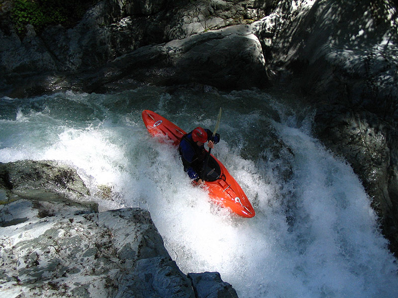
We had already reached the confluence with the main fork of Dillon and the flow nearly tripled as the two tribs joined forces and fell away into yet another claustrophobic looking gorge. Chris was unfazed by the increase in flow and led the way, boofing hard off another twenty footer with a boiling lead-in to a munchy hole. He easily punched the moderate recirculation at the base of the drop.
Chris Korbulic probes the second twenty-foot falls
After a few more interesting drops, gorge opened slightly and gave way to a few miles of class three and four. This section would have been awesome with more water, but neither of us was complaining about our low flow with the anticipation of the unportagable stuff that might loom around every corner.
With the addition of the North Fork Dillon, the flow doubled and a serious bedrock gorge loomed in the distance. From our map, we had assumed that a small tributary called Cedar Creek would indicate the start of the tough stuff, but we were only just below the North Fork confluence and the emerald green waters of Dillon began dropping into a mind-boggling boulder garden
Chris Korbulic enters the gorge below the confluence with the North Fork of Dillon Creek.
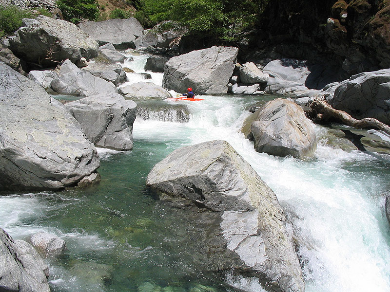
Our low flow was now paying off with brilliant pool-drop style boating through 400 fpm New Zealand style boulder gardens. This is some of the most enjoyable boating that I have done, but significantly more water would make this section ferocious!
Chris Korbulic in the amazing New Zealand-style boulder gardens.
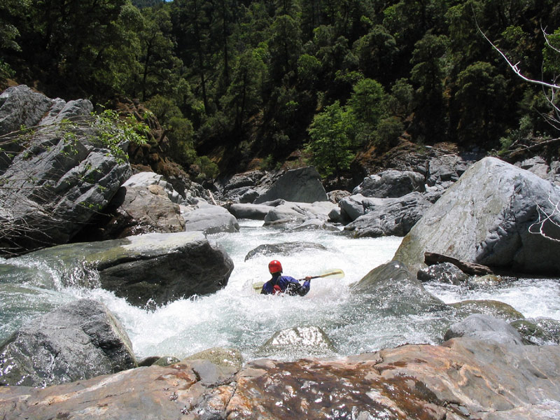
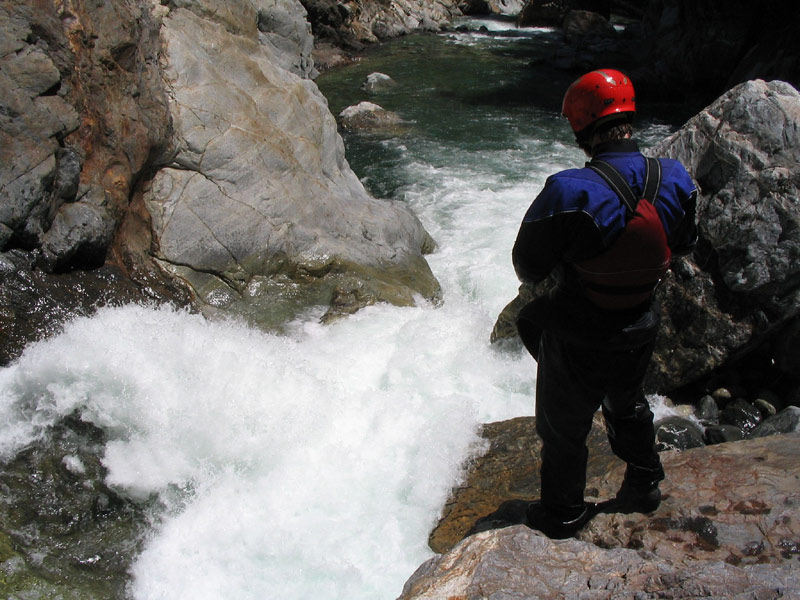
We took lunch at a point to enjoy the scenery where the riverbanks merged into towering canyon walls. This marked the entrance to Dillon’s fabled inner gorge.
Taking a lunch break at the entrance to Dillon's fabled inner gorge.
A short distance downstream we encountered a spicy double drop that ended in an undercut whirlpool which we both quickly portaged.
Chris checks out the spicy double drop that we both portaged.
As Cedar Creek cascaded in from the right in impressive Granite fashion, we lost the option to portage. Luckily our low flow exposed rock ledges and boulders which allowed us to have a peek at what the stuff we had to run. Several nice ledge drops and boulder gardens led to what we immediately assumed was the crux.
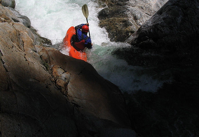
Chris runs a fun boof-drop leading up to the crux section.
Chris runs one of the nice ledges just above the crux section.
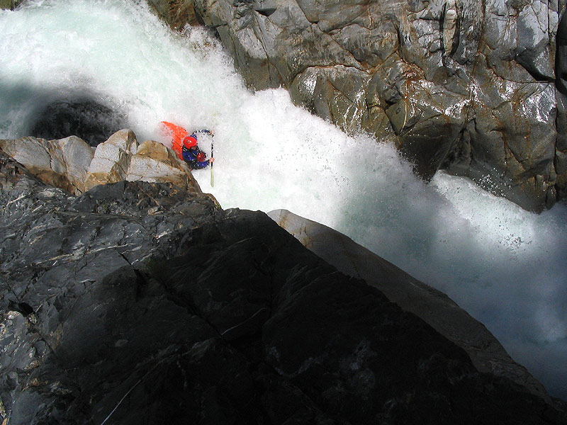
Again scratching our way to an overlook high above the river we were able to get a look at what we would be forced to run. On both sides of the river smooth rock walls soared hundreds feet overhead hemming the entire flow of Dillon into a semi frightening 20 to 30 foot tall sluice with with a nasty undercut wall on the right.
This double-dropping sluice was guarded by stout series of ledge holes that led to a lateral that pushed towards the wrong side of the massive sluice. Were it not for our perfect water level, we would have been forced to run this nightmare without a scout.
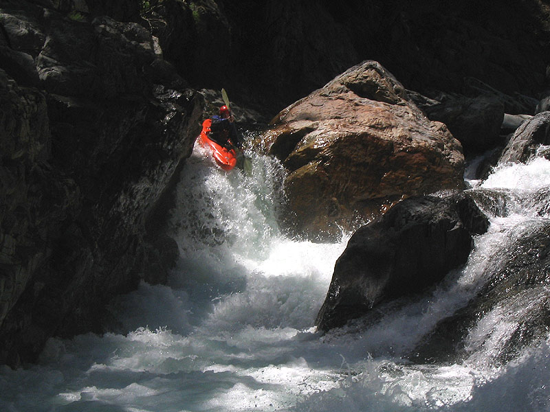
Chris was anxious to get this one out of the way, and I was anxious to see him probe the drop. After faring well through the first two ledge holes, he was rejected by the lateral to the right and disappeared under the right undercut wall in a frightening fashion.
Chris emerged below the undercut and rolled up after being underwater for twenty feet, and I found myself really wished that I had gone first!
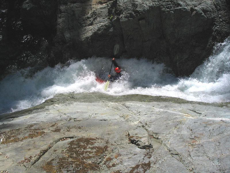
Chris drops into the huge, intimidating must-run sluice falls. He ended up getting flushed into the undercut on the creek-right, emerging upside-down twenty feet downstream..
Neither of us swam which broke Dillon curse, but our success in the Canyon was certainly do in large part to the low water level. At the takeout under the highway 96 bridge the flow was 250 to 300 cfs. More water would make this run increasingly exciting to the point of terror.
If you are thinking about this run I recommend a similarly low water level, and an early start. With only a short ten minute break for lunch, it took us 7.5 hours from car to car. Please note that any attempt to hike out of this Canyon would be futile at best as this canyon is extremely deep, sheer-walled, and isolated.
The take out for Dillon is conveniently located under the highway 96 bridge where crystal clear creek water enters the big brown Klamath. To get to the put-in follow 96 west a half mile Eyesee road. Stay right at the first fork heading up and over Dillon Mountain towards Siskon mine.
After driving along the ridge in between Rock Creek and the Dillon drainage, take a right after staying left at an old abandoned shack. From here it is a quarter mile to the Forest Service gate, where the four to five mile hike begins down to the put-in on Copper Creek.
2. Shifting wood in the lead-in rapid to said falls may or may not have shifted into potentially lethal locations with the storms of each passing winter.
3. Many drops from Dillon Creek are featured in Scott Lingrens ground breaking yak porn "Good 2 The Last Drop".