
Yet.
John Whaley and I had hiked up nearby Eagle Creek and seen the numerous waterfalls that section had to offer, which intrigued us even more. Finally this year we knew it was high time (so to speak) to give Multnomah a try. Of course, the geology indicated that there was a high probability (certainty?) of finding waterfalls...
John hiked up to the headwaters of Multnomah and confirmed that there was indeed a series of waterfalls above the big one. "Some are runnable, some not." He said later. "Should be short but interesting. The last drop is right at the lip of the big falls - this cowboy will definitely be walking that one."
Finally the opportunity came when I was home on vacation from college in Idaho. I grew up near the put-in for the Wind River, so when I came home I wanted to do some paddling! After doing an exploratory run down nearby Oneonta gorge, we packed up the boat and headed up to Multnomah.
We reasoned that we would only need one boat, so we brought my Eskimo Diablo; we figured we could take turns running the section above the main falls. John packed the boat and I carried the paddling gear. It would be easy to take photos due to the trail, and we could set safety as necessary. Because the area around Multomah Falls is so popular with tourists, we knew it would be impossible to keep a low profile. Nevertheless, we figured that if we wore regular clothes maybe we could say the big yellow plastic thingy was a listening device for birdwatching or something.
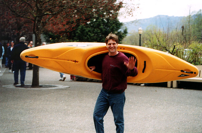
Boy, we got some LOOKS on the way up! All the way up people were gaping at us and nudging each other in disbelief. We also got just about every question you could imagine. "Where are you going with THAT?!?" ...
"You going to run the falls?" ... "Heh heh... you boys are crazy!"
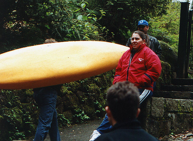
Finally the inevitable happened: we were spotted by a Self-Important Park Ranger With Nothing To Do.
(There may not be a more dangerous creature than a Self-Important Park Ranger With Nothing To Do..) John groaned in frustration when he saw her coming and we picked up the pace, but she walks those stairs for a living so she quickly closed the gap. As soon as we saw that we weren't going to lose her we stopped and braced for the inevitable assault. She rolled up, took a deeeep breath, and started crowing at the top of her lungs. I thought her eyes were going to bulge completely out of her head, so I kept my distance...
"What are you DOING?" she cried. "You're not taking THAT up there, are you? Are you going to be taking PICTURES of you KAYAKING this creek? Thats ILLEGAL!" (Ummm, no it's not, but nice try... -ed.). I don't think this is a very GOOD IDEA and frankly it seems like a VERY DANGEROUS THING TO DO."
It took us a few minutes to convince her not to shoot us on the spot or haul us off to jail, but after ranting and raving for a couple of minutes she finally let us off the hook with one final reprimand:
"Don't EEEEVEN THINK about PUBLISHING any of those photos anywhere-
I don't want any other KAYAKERS up here, do you UNDERSTAND me?!?"
Oh yes, we assured her. We would never THINK about publishing the photos; and even if we wanted to, wherever would we publish them??
We breathed a sigh of relief as she bustled self-importantly back down the trail, and resumed our upward trek.
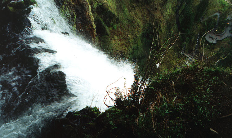
Finally we reached the top of Multnomah Falls, and of course I had to creep right to the edge and get a photo. It was thrilling being at the top of a five hundred foot waterfall, especially considering we were about to run some big drops right above it!
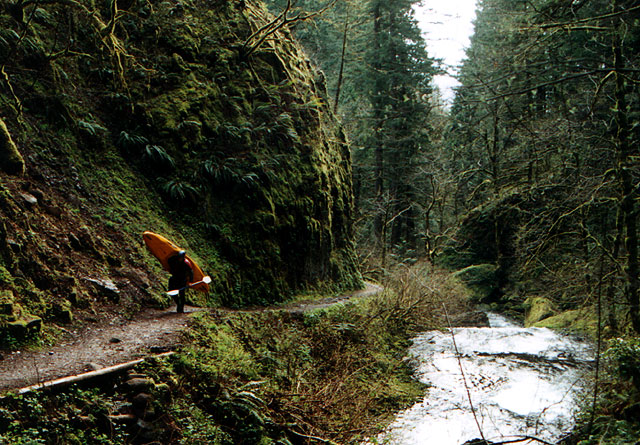
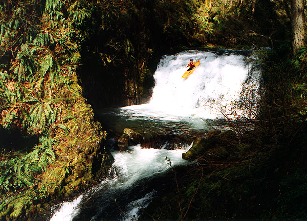
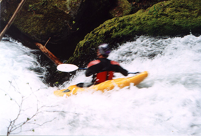
Upstream of the 80 foot falls where we put in is a short 75 meter section with more class IV ledges, then another ~80 footer. The trail runs along the creek here, so access is easy. When hiking upstream above these unrunnable falls, the creek is perhaps runnable for less than a kilometer. A footbridge crosses the stream from river left to right as you walk upstream.
At this bridge, a potentially higher put-in might be considered someday. All of this can be observed in places 100 feet above the creek on a well-maintained trail. One boulder ledge drop of perhaps 12' is my main concern. It appears to be best on the extreme river right with what appears to be a marginal tiny shallow pool below. The lead-in appears to drive you more left towards an even worse rocky drop zone.
This section is a combination of bedrock and boulders with extremely steep gradient. Not entirely certain just how steep this short section is as the waterfalls below make an honest accurate account difficult. It appears significantly steeper than any other section I have paddled before. It is steeper than Oregon's Christy Creek or California's Indian Creek that head into the 400' per mile range.
Having enough water would also be of concern. The best ideas known yet are either the Bull Run River listed near Multnomah Falls or the East Fork of the Lewis in Washington. Maybe 800 on Bull Run near Multnomah or 1800 on the EF Lewis would be a good estimate.
Above this footbridge, the stream is basically too small without the aided channeled basalt bedrock. Upstream it crashes down through a complete mess of smaller boulders and wood for several miles until becoming too diminutive for further study.