Panther Creek is a another Columbia Gorge classic and one of my all-time favorite runs. This creek cuts through the three hundred foot canyon wall that lines the Wind River near High Bridge. Panther is packed with rowdy rapids at medium flows which become a single giant rapid at high water. Even though the creek isn't that far from Carson, once you drop into the steep section you feel like you are a million miles away from civilization ( and given the steepness of the canyon walls, you might as well be ). Keep that in mind when this creek is running high!
Panther is another run in the Columbia Gorge that recently went online with an internet gauge, making flow prediction and planning much easier. The road to Panther is always plowed, so access is easy. The only downside of this run is that you can't take out at the bottom and have to run the Lower Wind every time. Not that the Lower Wind isn't fun, but it would be more fun to do laps on Panther!
Below the put in the creek eases you into things with some easy class two-three eddy hopping and bouldery drops. There are a couple of bigger drops, but nothing too serious, easing you into things as you move downstream.
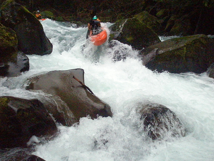
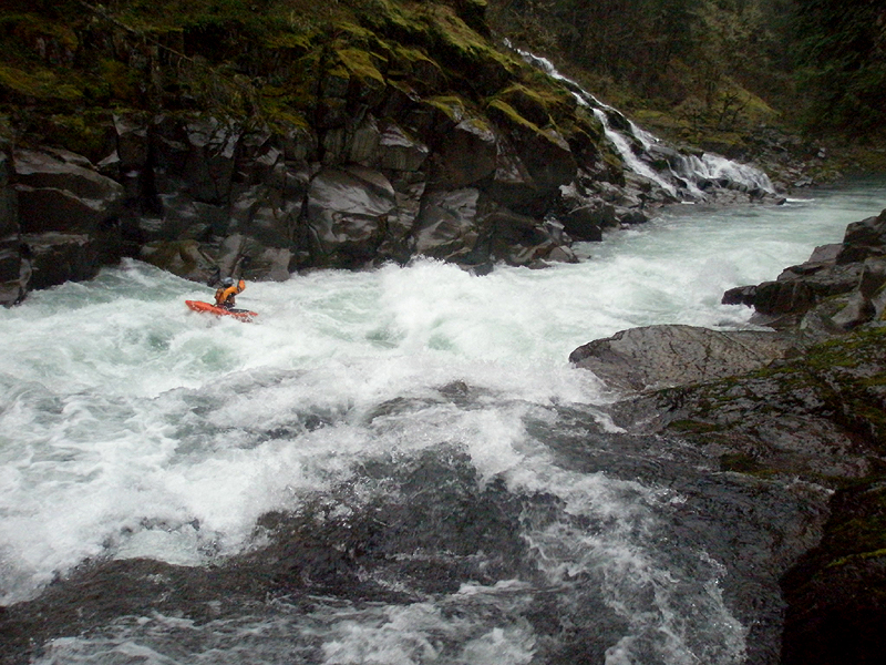
About a quarter of a mile below the put in the tone abruptly changes when you reach a large horizon line marking Raychel's Drop. If you are having trouble on the stuff above Raychel's, hike out now. Below Raychel's the creek jumps one level of difficulty and never really lets up until it reaches the Wind, far below.
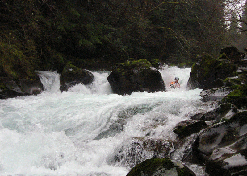
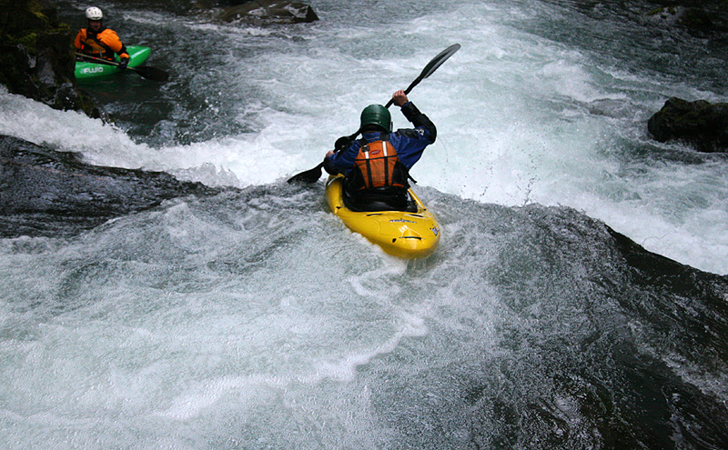
There are three doors at the top of Raychel's, and the far left side is the only line I've seen run. The left side of Raychel's is a very violent slot drop that requires precise handling to avoid a broken boat or end-to-end pin. The slot feeds into a hole, and then fast water leads to another steep slide into a hole with more rapids immediately downstream. A mistake here would be the opposite of fun.
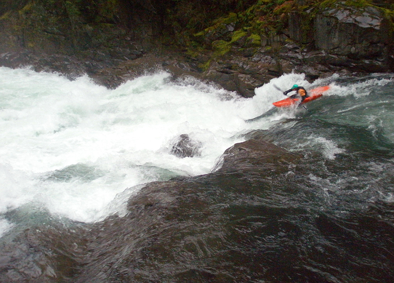
Move one of three at Raychel's: Local pro Jesse Coombs runs the slot-drop at the top of Raychel's.
Photo by Pete Giordano
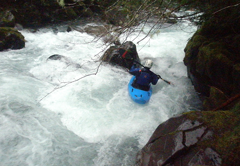
Move two of three at Raychel's: Jesse Coombs punches the hole below the slot-drop in Raychel's.
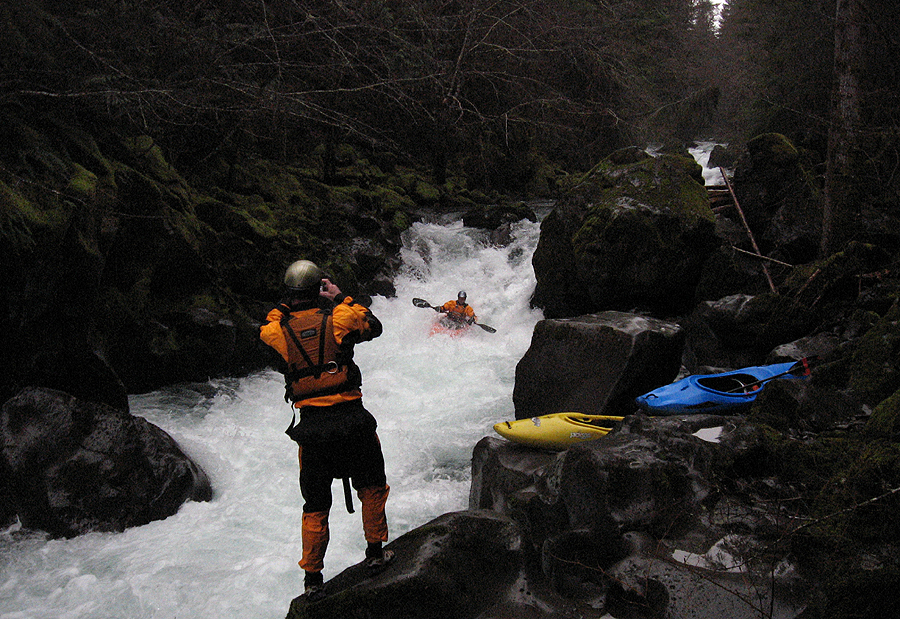
Move three of three at Raychel's: A photo of the author taking a photo of Jesse, running the bottom part of Raychel's.
Photo by Pete Giordano
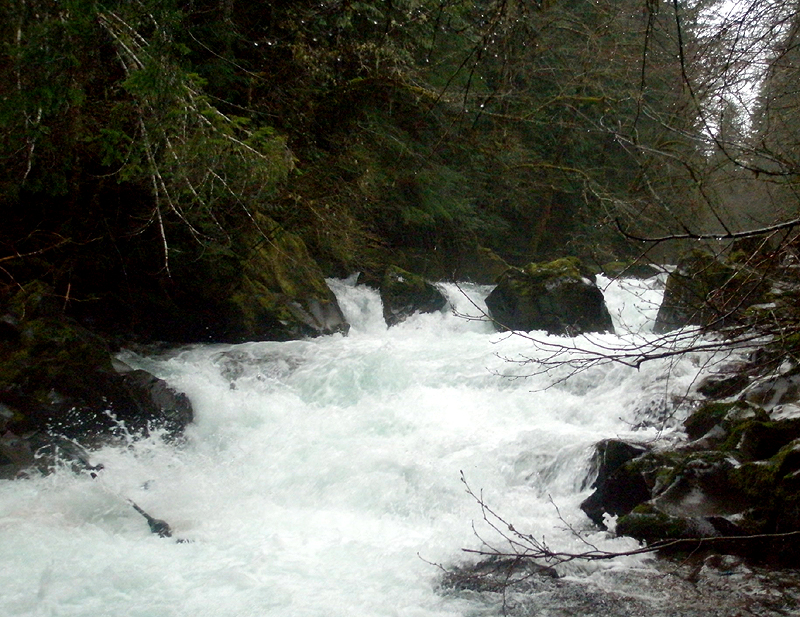
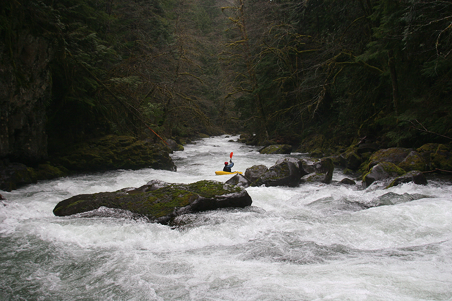
Looking downstream from Raychel's Drop. The creek never slows down after this..
Photo by Pete Giordano
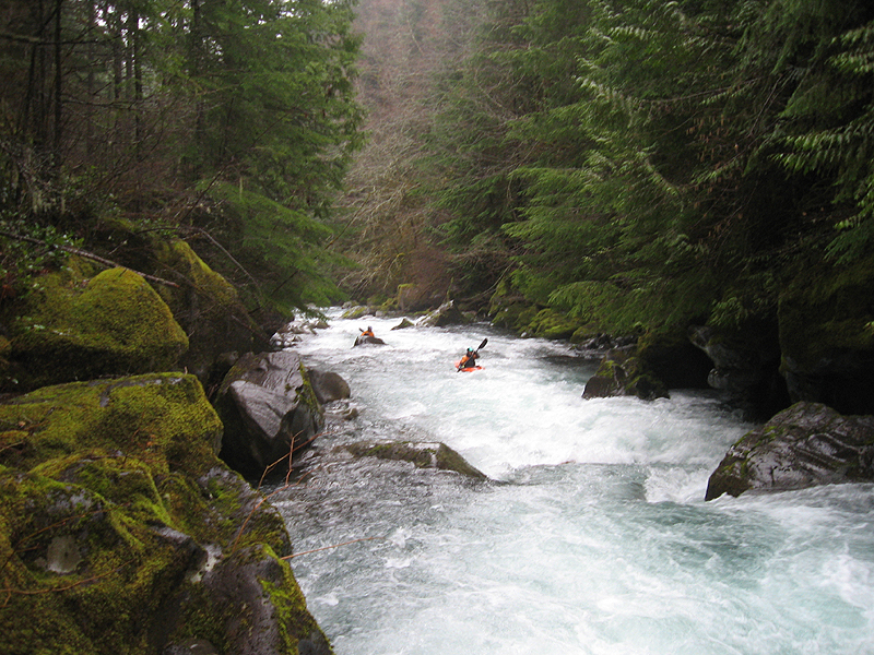
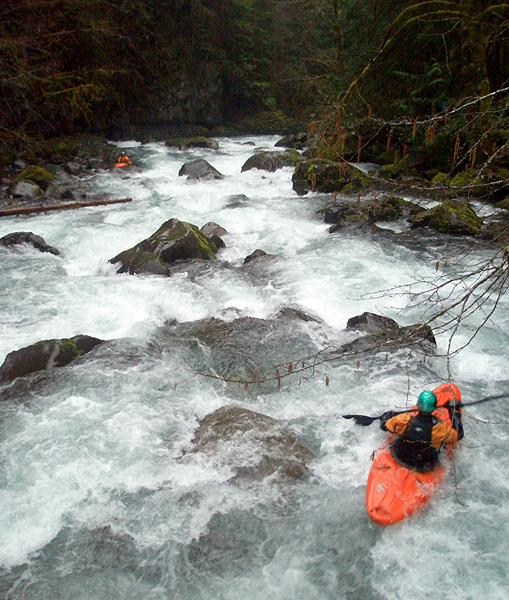
Below Raychel's the creek starts rolling through a non-stop series of rapids. The next drop is a steep boulder-choker that is hard to scout, especially when the creek is high. Generally, you can get out on the right and peer downstream, or just go for it. At medium flows the right side is usually best, just try to stay off the right wall. At high water ( above 30 inches on the bridge gauge ) lines open up down the left side.
Immediately downstream is a fun airplane boof move, it is also a little challenging to scout this one but you can do it with some tight eddy-hopping down the right side.
Generally, we only have one person scout each drop for wood and direct traffic on Panther Creek. This is the best strategy because the eddies are small and tight so it can really slow things down if every single person looks at every single drop.
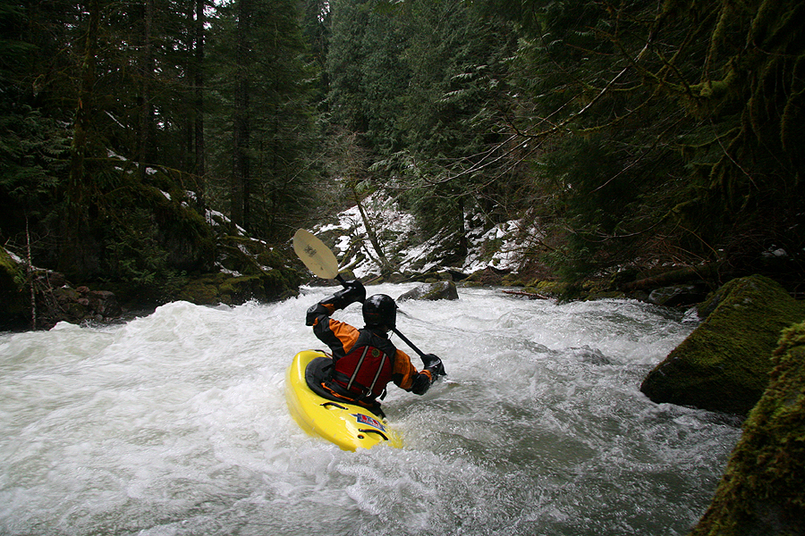
James Bagley Jr. gets busy just downstream at the airplane boof..
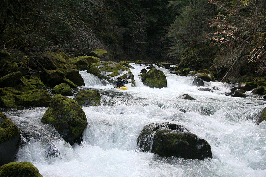
Just downstream of the airplane turn drop the creek widens and most of the water goes left at medium flows. Run the lead in to the next drop left, then ferry back to the right to run the main part of the drop, avoiding the sieved-out pile of boulders in the middle of the creek. The move to avoid the sieve isn't that hard, but it helps to know it's there.
Pete Giordano lines up on the sieve drop.
Try to avoid the nasty bit in the middle of the creek here by staying right.
Downstream of the sieve drop are more high quality rapids that kind of run together, leading up to the big one, a towering boulder garden that is the single biggest drop on Panther.
Running the rapids above the big one at high water.
Photo by Chris Arnold
The drops on Panther are almost always wood free, but this is the one exception because the creek widens and there are more rocks that trap logs floating down from the narrows above.
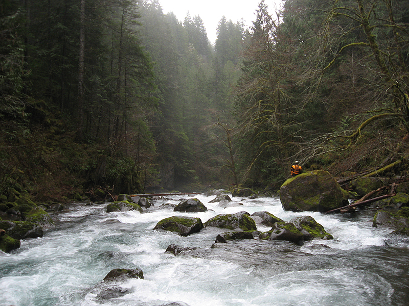
Always, always scout the big one for wood. This is easy to do, just get out on the right side and trek downstream.
Once you determine that the big one is free of wood, you'll have other concerns. At high water ( above 30 inches on the bridge foot gauge ) the big one cleans up but feeds into a drop immediately below that has a massive, uniform hydraulic. Be sure to scout the drop below the big one at high flows, for safety reasons.
At medium flows ( 23-27 inches on the bridge foot gauge ) the big one has some pin/piton potential in the middle. We usually go right at these flows and run the pourover on the right side. The drop immediately below the big one is less of a concern at medium flows, with a tongue through the left side.
Scouting the big one.
Photo by Pete Giordano
James dropping..
The big one, shot from the bottom.
Photo by Chris Arnold
The drop immediately below the big one features a large, uniform hydraulic. At medium flows it's manageable but at high water ( above 30 inches on the bridge foot gauge ) the hole is terminal.
This is the sloping ledge just downstream of the big one at medium flows. At high water this hydraulic is massive.
Photo by Chris Arnold
Once you get below the hydraulic drop Panther remains high-quality all the way to the Wind, with a series of excellent boulder gardens that we always just sprint down, whooping it up all the way. Panther is, to sum it up, way too much fun!
Cruising below the big one.
Photo by Chris Arnold
Panther requires a big rainstorm to run, so when you hit the Wind River confluence it will feel like you are on an ocean in comparison. A run down Panther is a study in contrasts. You start out on a low-volume steep creek and end on a high-volume stomper, each of which are the best of both worlds.
The lower Wind below Panther doesn't have a lot of action but the drops are impressive when they come. The first rapid is the Flume, which is located on a sharp left turn between vertical walls. Scout right at most flows, but note that at very high water there are no scouting options! The flume is a wild ride down through some crazy hydraulics culminating in a huge, exploding wave-hole.
I remember one really crazy high water trip down the Lower Wind with Pete, back when we both paddled Gradients. The Flume was huge that day, and I remember Pete charged down into the big wave-hole and the wave exploded when he hit it, tossing him into the air. He did an aerial barrel roll and almost landed it, but I think he was so surprised that he flipped over immediately downstream. I remember afterwards he was wide-eyed in the eddy below: "What was that?!?" He said. "I was upside-down but my head wasn't underwater.." To this day that is one of the craziest things I've seen on a river.
Jesse Coombs charges through The Flume on the Lower Wind, below the confluence of Panther Creek.
Downstream of the flume is a tricky little rapid immediately above a drop known as 'Beyond Limits'. At super-high water this lead-in drop is river-wide and you can paddle along the left wall and get out to scout Beyond Limits just below. At other flows you run down the right side through a folding hole. The move isn't hard but there is lots of funny water and pushy boils here when Panther is running. Try not to wipe out, because Beyond Limits is just downstream!
Beyond Limits is a rocky ledge with a fish ladder installed on the left side. We've run this drop every which way, including down the fish ladder, down the main line on the right, etc. At super high water ( above 30 inches on the Panther Creek bridge gauge ) Beyond limits a massive river-wide uniform horizon line, the fish ladder nowhere to be seen. We portage at those flows!
James Bagley Jr. drops into the massive hole at Beyond Limits at 23 inches on the Panther Creek bridge gauge.
The last big rapids on the lower Wind are known as Shipherds Falls. These falls are commonly run in the summer at low water, but when Panther is running they are class six. At very high flows ( above 30 inches and up on the Panther Creek bridge gauge ) the backwash from the holes surge up onto the fish ladder, and the whole structure vibrates when you walk down it. Anyone running these falls at the high flows required to paddle Panther Creek will almost certainly not survive.
Recently there has been some conflict between local law enforcement and paddlers portaging down the fish ladder. In the spring of 2009 I talked to a Sherriff's deputy near Carson and he said that portaging down the fish ladder is not allowed. From what I understand, there is another portage path on the right side, but I've never seen it.
|

FLOWS: Panther only runs after heavy rainstorms and in the Spring during the snowmelt. There is a
paddlers gauge under the put-in bridge for the steep section, and a new internet gauge that we are in the process of correlating to the old foot gauge. The photos on this site where taken in the twenty-three inches on the bridge gauge, which is a class IV+ flow and is probably about 300 cfs on the internet gauge. This is an optimal medium flow. I have run this section as high as thirty inches and rising on the gauge, and it got pretty hectic at that flow and the run was class V. Probably closer to 800 cfs maybe? If anyone gets a good correlation between the bridge gauge and the new cfs online gauge, please let me know.
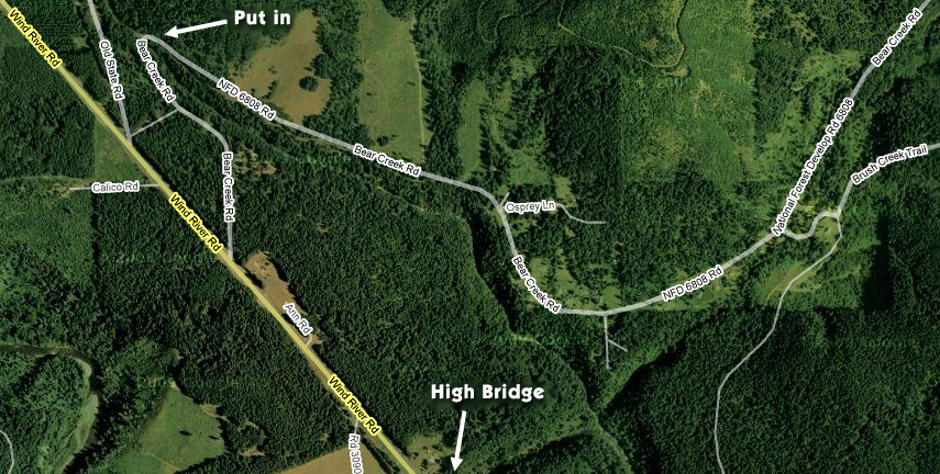
DIRECTIONS: The most commonly run section of Panther is the steep section, which contains 99% of the rapids on the creek. The Bennett Guide describes a more complete run of Panther, putting in four miles farther upstream. Pete and I ran that section the first time we did Panther, and the upper four miles were mind-numbingly dull.. Don't do it! Put in and run the steep section, which is the lower 1.25 miles.
The put in for the steep section is located by heading north out of Carson on Wind River Road. After you cross High Bridge, look for Bear Creek road on the right ( see map below ). Turn on Bear Creek and drive down to the bridge over Panther. There drive over the bridge and up the road about a hundred yards to a small gravel pull off on the right side of the road, this is where we usually park.
For directions to the take-out, as well as other info, pick up the second edition of the bible, Jeff Bennetts 'A guide to the Whitewater Rivers of Washington', a book no serious Northwest paddler should be without. You can pick this book up at your local paddling shop, or on amazon.com.
|
