
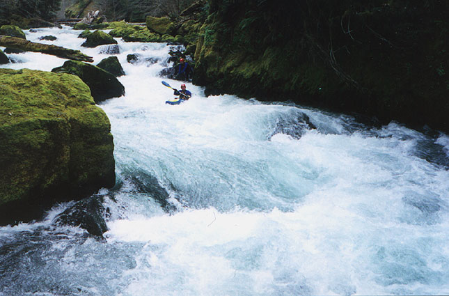
Just below the put in the action starts immediately a right side sneak under some logs. Just below here is a narrow III+ drop run down the middle. Below this drop get ready because just below is a drop we call Holy Terror, a steep class IV+ to V boulder garden that is very pushy at medium flows and (you guessed it) a hole filled terror at high flows. Holy Terror starts with a hole that can be quite sticky at some flows. Below the hole the creek blasts down through a long, steep boulder garden. Boaters who swim in the top hole (it has happened...) are in for a very long day indeed because the chances that someone will be able to corral your equipment in the gorge below are slim to none! (We speak from experience on this one!)
The last major rapid consists of three drops that start where the creek takes a sharp right turn and is almost completely blocked off by an enormous boulder on the left. Catch the large eddy on the left behind the boulder and scramble up on top to scout the first part of this drop. At the top of this rapid the creek narrows down to about ten feet and drops over a uniform three foot ledge. Last year the boof was partially blocked by wood which is now gone. Below here boaters charge down and do a wild airplane turn to the right at the bottom of the second drop, avoiding the large hole river left. Below here is a short pool above the last big drop.
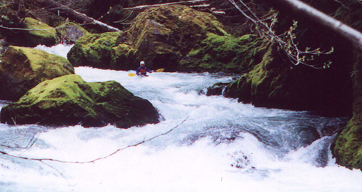
Ely runs the boulder drop
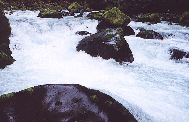
Ely runs the bottom drop in the gorge.
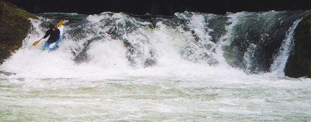
The author runs Salmon Creek Falls
Access: From Eugene, take highway 58 to Oakridge. Drive through Oakridge and cross Salmon Creek. Look for the fish hatchery signs and turn left there. Continue up this road for about a mile until it ends at Salmon Creek Road (FS 24). Turn right here and drive 2-3 miles and turn right on a small road (FS 207). Right before FS 207 crosses the creek, a footpath leads off to the right. The footpath crosses the creek about two hundred yards away and this is the take out. You can scout the last III+ rapid from the bridge. Return to FS 24 and drive up to Salmon Creek Falls Park and scout the falls from the wall of the gorge. After scouting the falls, continue up FS 24 and until you see a road (FS 2408) taking off to the right, crossing the creek (an alternate put-in if you want to miss the gorge). The put in for the gorge is 1.5 miles above here. Stay on FS 24 and drive up 1.5 miles, looking for a small rut-filled turnout on the right. Scramble down the path and put in. Don't bother continuing upstream unless you enjoy endless class two with tons of wood.
Flows: 400 cfs and up. Salmon Creek runs at the usual times, after some rain or during the spring snowmelt. This creek only corresponds with Pat Welches usually reliable calculations about half the time. We ran it once at high water when Pat's site said it only had 57 cfs, so you just have to guess right. The Falls is the best visual gauge- the shot in this report of Salmon Creek falls was taken at medium high water. For a more educated guess, Mike always figures it this way: The approximate level is about 20-25% of the difference of the inflow to Lookout Point Reservior minus the outflow from Hills Creek Reservoir. (Call 937-3852 for the flows)