
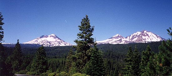
Nice views of the Three Sisters in Oregon's Cascade Mountains on the way to the put in.
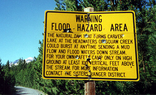
We left a car and headed upstream. Once on the road the creek drops out of sight down into a deep canyon so we drove six or seven miles without seeing the creek at all- on the way up we encountered a disturbing sign. Apparently there is an ice dam up on the glacier that could burst at any time, sending a wall of water and debris downstream. The sign warned that you should "camp at least one hundred vertical feet above the creek" to avoid being swept away by the flood of mud and logs. "Good thing we're not camping up here; sounds dangerous." I joked. We found out later that they have plans to evacuate the town of Sisters when it happens, and that is twenty miles away!
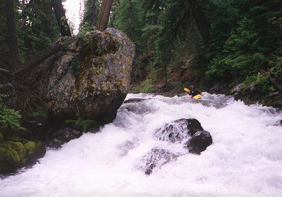
Anyway, we arrived at the put in and were pleased to see that the creek had plenty of water- it was at full bank flows, which is very unusual for a free flowing stream at the end of July. The put in is a class III rapid, providing a nice little warm up for the much tougher stuff downstream.
Mike flashes the ubiquitous 'Team C' hand signal at the put in.
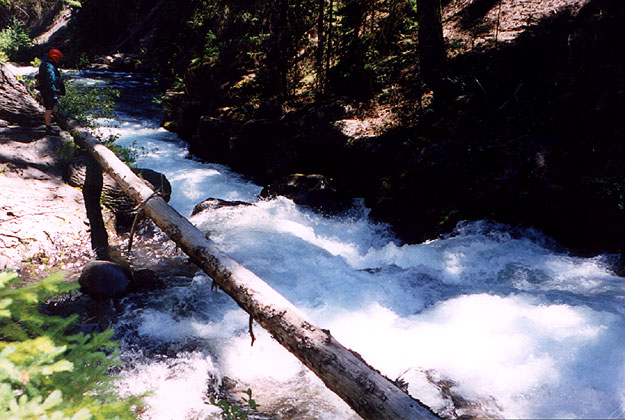
Below the put in the creek bed was narrow, only about 30 feet wide, and very fast. There were very few eddies and lots of wood. The first couple of miles were non stop class II water, easy and fun. A mile down I rounded a corner and saw a horizon line drop that looked like it had some wood in it. Turns out the drop was formed by three large logs, and I saw Mike in the pool below, frantically signaling for me to stop. I got out, walked around to the drop, and swore. "You ran that?" I said incredulously. "Yeah," Mike said. "Luckily I ran right, boofed off of the root wad, and landed in the eddy." If he had run it any other way it would likely have been fatal- the bottom log was perfectly positioned to entrap the bow of a boat. That was our wake up call- Squaw Creek is not for the timid! Of course, this was nothing compared to what we encountered downstream, but I digress...
We continued downstream, and I remember thinking "If this thing gorges up it is going to be a real screamer." I had no sooner thought it than the river gorged up and dropped out of sight around a corner. Vertical rock walls rose right out of the water, and through my earplugs I could hear the roar of the rapids below. We got out and hiked downstream to scout. We dubbed this rapid "The Finger" because of the distinctive finger like rock at the top and the serious consequences of a mistake below. The entrance rapids on the corner were class III complicated by several strategically placed logs and rocks.
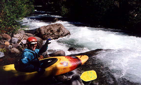
Scouting the entrance to the finger.
Once around the corner there are no eddies, no stopping- one hundred yards of pushy holes and waves plunging between vertical rock walls the whole way down culminating in a big class IV drop with a big hole and a rock in the middle. Below this the creek rushed for another fifty yards into and under a creek wide log jam. There could be no swimming, because the least you would lose is your equipment in the logjam. I started sweating at this point! I knew I could do it, but there was no room for error.
Before running big, hard drops I always do the spit test. If I can spit, I run it. If I can't spit and I feel like I am going to throw up, I walk it. I spit and said "Let's do it." Mike went first, being the probe for this trip. I followed, threading my way through the corner drop, avoiding the logs and punching the diagonal hole at the bottom. I rounded the corner and saw Mike, two hundred feet ahead, enter the class IV exit rapid on the right side, dropping out of sight... I paddled hard through the gorge chute and plunged into the exit rapids on the left side of the rock, punching easily through the weakest part of the hole. Our exhilarated shouts echoed off the canyon walls as we eddied out below...
My run through the exit rapid of the finger.
We portaged the logjam and continued down through a few fun narrow rapids until we arrived at Jaws, a mean rapid with a pin rock in the middle of the main chute. At higher flows the difficulty of Jaws would ease considerably because there would be a fun 6 foot boof on the left, but it was blocked by a log so we decided to portage and eat lunch.
Mike contemplates Jaws...
From here the creek never let up. There were numerous blind class III and IV drops, all of which required scouting. There was no way we were going to run anything we couldn't see- with all of the logs it would have been suicidal. About four miles down I was waiting for Mike in a pool in the middle of a long class IV section when I saw another kayaker coming downstream! I was pretty shocked, considering the nature and isolation of the creek. There were two of them and they blew by us without scouting, dropping out of sight one after the other. We stopped in an eddy below and one of them got really excited. "Have either of you ever done this before?" He asked. "No." Mike replied. The guy looked at us and shook his head. "You guys are crazy!" It turns out one of the guys is a Prijon rep for Bend. They have run Squaw forty or fifty times and have it totally dialed in. They offered to let us trail along behind them, but we demurred, once again erring on the side of caution. (Mike and I like to go home at the end of the day, and if you follow someone down a creek like that you might not)
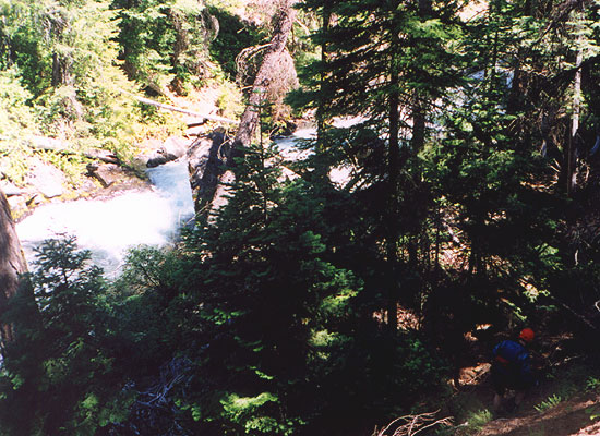
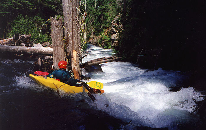
Mike on one of many fun drops in the inner gorge. This is the entrance move to a trickier, larger drop just around the corner..
We continued at our relatively slow pace, scouting often and portaging the occasional logjam. Suddenly the creek slowed dramatically and actually formed a pool. From experience we knew there had to be something huge was ahead! We rounded the corner and arrived at Cottonmouth, an intimidating rapid formed by a massive logjam crammed between vertical rock walls. This rapid would be very difficult to portage. We easily eddied out and walked over to the right side of the jam, where most of the current flowed. "Well, I hope there's a line," I said to Mike as we waded downstream. "Because we don't have much of a choice..." It was run it or walk out, and what we saw was a 'runnable' logjam....
The river poured over the logjam and down into a series of big holes and rocks with wood everywhere. You had to stay right in order to keep out of the jam, but the upper right side had two logs in it. The lip of the drop was complicated by several sharp arm sized branches sticking up, and the lower drops required a difficult maneuvering in the holes formed by water cascading over logs with severe consequences for a swimmer. Rolling was absolutely not an option. This one failed the spit test. (hence: 'Cottonmouth') We both ran it without mishap, but it was very intimidating.
Just downstream we encountered another loggy section, and we worked our way through it slowly until we sat above two logs suspended about two feet over the creek, obscuring the downstream view. Mike went first, slowly back paddling and then laying back over his stern to go under the first log. Suddenly, he got hung up on the log and flipped in shallow, fast water, disappearing from sight. Concerned, I paddled downstream, braced and bashed my way under the logs and emerged in time to see mike, out of his boat, being swept into a narrow chute on the right side of a huge logjam. As I watched he dropped from sight.... Time seemed to slow as I eddied out and bailed out of my boat, sprinting downstream at a reckless pace over the logjam all the while calling Mikes name. I saw his boat broached on a rock about a hundred feet downstream, but no Mike!
Panic stricken, I yelled and ran downstream. Suddenly Mike emerged from
behind a boulder on the other side of the creek and waved. Much relieved,
I went back up and got my boat. By the time I got back downstream Mike was
ready to go. Luckily his boat had broached on a rock near shore, because
fifty yards downstream was the first of two long, log-choked drops that we
portaged on
the right. Mike said later that he got flipped and was unable to roll due
to
the shallow water and the speed of the current but he had gotten a glimpse of what he was being swept into so he had decided to swim for the right. That was definitely the right call, because if he hadn't he may have become 'one with the river."
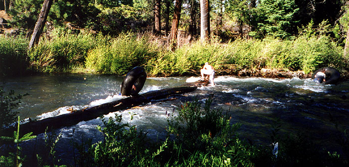
What are a Redneck's last words? "Hey, watch this!" - Some local tubers get worked by a log on Squaw Creek.
We hiked out and drove home, exhilarated, exhausted, and totally satisfied. We were pretty pleased that we only portaged one rapid due to its inherent difficulty (Jaws). The other eleven portages were due to dangerous log infested rapids with low percentage moves. When Mike got home he went to the Prijon Kayak web site and contacted the prijon rep we had spoken to on the creek. The guy mailed Mike back and said that they have shaved the run down to six portages... As a footnote, the pro guy Mark also said there is a chance that the creek will be irreversibly damaged when the dam finally breaks- it may become totally unrunnable in the aftermath of the enormous mudslide. I feel very fortunate to have run this creek while it exists in it's pristine state.
We ran this creek in July 31st and August 8th 1999 and there was plenty of water. The snowpack was at about 150% of normal if I remember right..
We arrived at the take out and passed some teenagers at a campsite. They had inner tubes and hopped in the river as we were taking out. As we were getting ready to leave three of them floated around the corner and got worked over by a river wide log.
Upper Squaw Creek (FS 1514 Bridge to Gaging Station 4.3 miles south of Sisters)
Class:IV+ ( P )
Gradient: 150 fpm Continuous
Length: 6.5 miles.
Access: From the town of Sisters, turn south on S. Elm street and proceed 4.3 miles. When the main road begins to go up a steep hill, there will be a small dirt road on the right at the base of the hill. This small dirt road parallels the main road for about 200 yards then turns right drops down to a small bluff overlooking the creek. This is the take out. If you do not have a four wheel drive vehicle, park up by the main road because the hike up from the creek is pretty easy. To reach the put in, return to the main road and continue up the steep hill. Drive for a few miles until you see a major gravel road taking off to the right with a sign for Squaw Creek.
You should cross a cattle guard within 75 meters of turning onto the road. Stay on this road for several miles until you come to the bridge crossing Squaw Creek. This is the put in. For additional Class IV-V action, there is a poorly maintained road that takes off uphill on the left just before you reach the bridge. You should be able to put in as high as you wish. The authors have only run part of this upper section, which is very steep and woody.