I had never heard of the Cascade and haven’t known Ryan all that long, but he knew I wouldn't say no.
The following Friday evening Eric, Garry, Ryan, and I headed north out of Portland into Washington. After a quick stop at Burgerville ( which we would be reminded of all weekend ) we were on our way. Around midnight we arrived at Rainy River campground located just outside of Marblemount near the Cascade River. The price for a campsite was pretty cheap, five Bucks a night for two cars! ( Look for the small white sign just after the bridge ).
The Bennett guide describes the Cascade as "a perfect river", and after two days on the run I wouldn't be one to argue. The Cascade runs late into the summer, fueled by the massive snowpack of Washingtons Northern Cascade Mountains. The great camping, superb continuous rapids, and amazing scenery all add up to make the Cascade River a classic Northwest summer paddling destination.
We got up Saturday morning in the bright August sunshine and got ready for a great day on the river. The Cascade starts off calm before the first major rapid, which is aptly named "Starts With A Bang" ( hereafter SWB ). SWB consists of several ledges and sizable holes. A swim here would be bad news, you would be in the water for a long time and take a beating. Bridge drop is just below Starts with a Bang and you do NOT want to swim this one either. On Saturday we scouted both rapids thoroughly, checked them for wood, and picked our lines before running them.
Ryan, Eric, and Garry scouting Bridge Drop from the road during the shuttle.
We ran all of SWB the river right side with the exception of the entrance which we ran on the left Sunday.
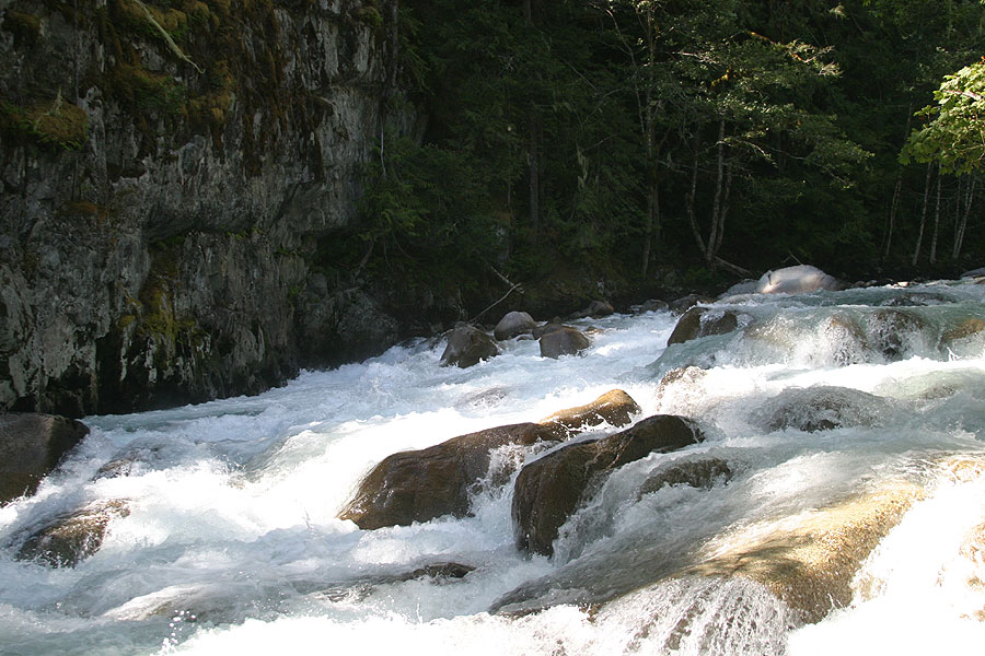
Garry punching the first hole in 'Starts with a Bang'.
After the entrance drop there is a large rock on the river right side with a large eddy behind it. Below the rock are more fun drops. First, a small ledge drop that was a bit sticky; no one got worked, but it endered two in the group. The ledge is followed by a small hole and a small slide.
Eric is just below the large rock (far background) and C.J. Arnold (center), working their way through the middle section of 'Starts with a Bang'..
There were two holes to punch just below the slide. The second was larger, but both were easily punched.
The author, punching the first hole. There is a second, larger hole just downstream.
Just downstream of the middle section of SWB is a large eddy on the river left. We all eddied out left and then ran the final pitch on the right side.
Ryan C. finishing the last sequence of SWB. The entrance to Bridge drop is visible just downstream.
There are two eddies that you can catch before the next rapid, Bridge Drop. In the photo above, eddy out just above Ryan C. on the right, or punch the hole just below him and eddy out right. The entrance to Bridge Drop is just below that eddy ( In the photo above, the entrance is located just below the large boulder on river right ).
Bridge Drop used to contain the remains of an old bridge which created a deadly strainer. Over two consecutive years two kayakers became entrapped and drowned in the remains of the bridge, causing American Whitewater's Northwest River Stewardship Director Thomas O'Keefe to lead an effort to get the bridge remains removed. After many meetings and negotiations, the bridge debris was finally cut up and removed. Click here and select 'photos' to see pictures of the bridge removal on the AW site.
We all opted to walk the entrance hole to Bridge Drop. There was a large piton rock on the left and a large hole on the right side. The far right side looked like it might go, but it was backed by a large rock a few inches below the surface of the water. It seemed feasible to sneak the piton rock on the left, but none of us fired it up. On Saturday as we were taking off the river and running shuttle we ran into a woman whose friend, a fellow kayaker, lost his life there!
Below the entrance drop was a shoot followed by a fun sequence of ledges. We all opted to run the right side. The left side had more water, but there was another large hole backed by a large rock in the middle of the left line.
The author, eddied out above the final sequence of ledges in Bridge Drop
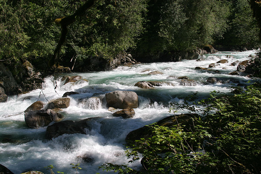
Bridge Drop was followed by several read-and-run boulder gardens. We were able to pick out way down following the "two eddy rule", and boat scouting everything. The next rapid of note is Premium.
Premium can be identified by a significant horizon line. We scouted the drop from river right and ran it from river left to right. There were two sizeable holes on the left side, one in the middle of the drop and one at the base. A few of us tested them to see if they were sticky but no one got trashed.
The best line through Premium was to ride a curler/diagonal hole down the entire rapid from left to right, or to use it to drive in to a small eddy on the far right and boof a small ledge. There were two nice eddies on the river left above the meat of the rapid that made setting up easy.
The author, following the curler/diagonal hole into Premium.
A moderate pool separates the outflow of Premium from the entrance to Monster. Monster is given a class V rating. We imagined our lines and then walked the drop conceding that it might be better at higher flows. The crux of the rapid is below the burley entrance hole.
We saw two potential lines: Option 1 consisted of a left-hand boof off the side of a ledge perpendicular to the flow. The front of the ledge dropped into a reasonable hole backed by a large boulder. Option 2 consisted of following a tongue and trying to get right before you get trashed against a large rock that broke up the tongue.
The bottom of Monster.
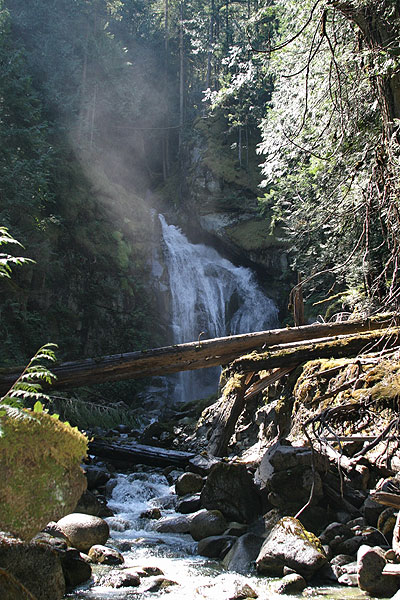
Just below Monster is yet another good reason to paddle this river. A tributary enters on the left, and boaters are treated to a spectacular waterfall. We concluded this was the best spot for lunch on the run.
What follows can best be described as outstanding read-and-run class IV-IV+ with numerous catch-on-the-fly eddies. We thought about setting up for some shots here on Sunday, but it was too much fun to stop.
A large headwall signals Shark’s Tooth. At the level we ran the river, this rapid contained several great spots to get pinned. Portaging on the left was easy. The far right side of the river dumped into the headwall.
A less-than-great shot of the bottom of Shark’s Tooth Note: Avoid the Right Side.
After Shark’s Tooth the river calms down with a few more fun boulder gardens and rapids to the take-out. On Saturday, we paddled back to our campsite adding a few miles of flat water. On Sunday, we found a pull-off on Cascade River Road and hiked out.
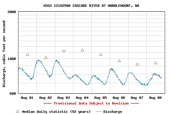
I meant to take a picture of the paddlers gauge, but I never got around to it. I believe there were approximately 1.5 grates showing. Flow rates for Saturday, August fourth and Sunday, August fifth:
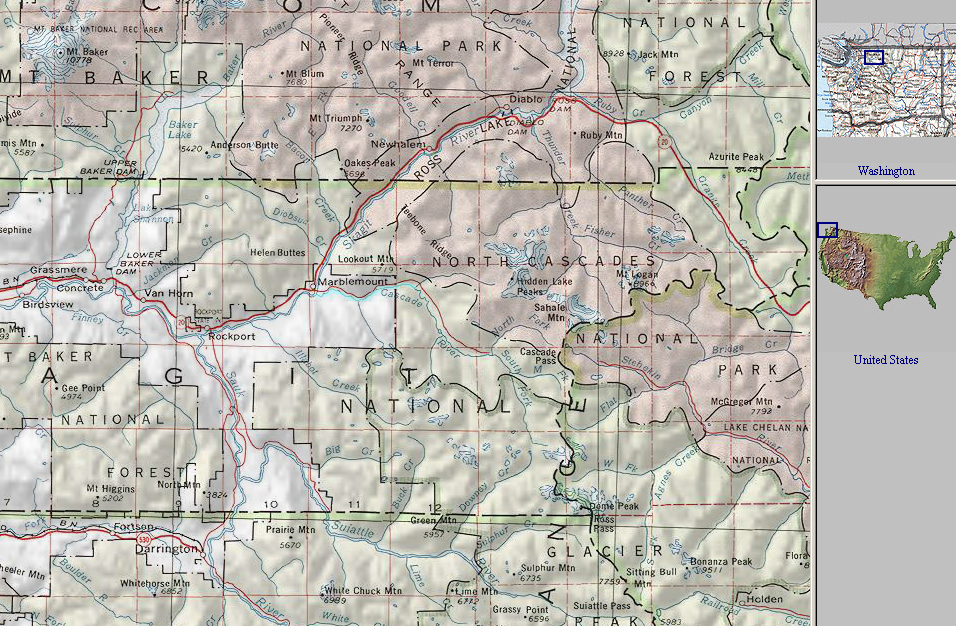
A map showing the location of this run. The Cascade is near the center of the map, highlighted in blue.
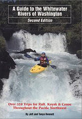
For directions to the put-in and take-out, as well as other info, pick up the second edition of the bible, Jeff Bennetts 'A guide to the Whitewater Rivers of Washington', a book no serious Northwest paddler should be without. You can pick this book up at your local paddling shop, or on amazon.com.
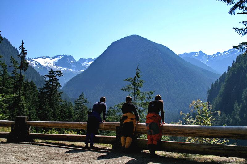
Photo: C.J. Arnold
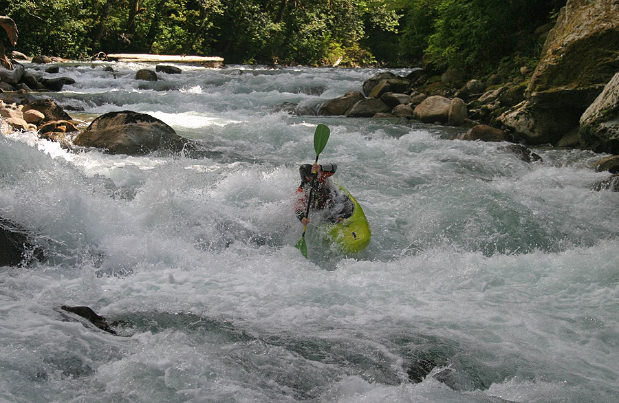
Photo: Ryan Cole
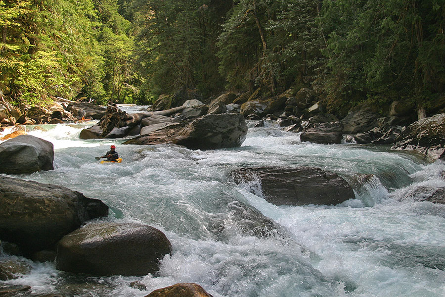
Photo: Ryan Cole
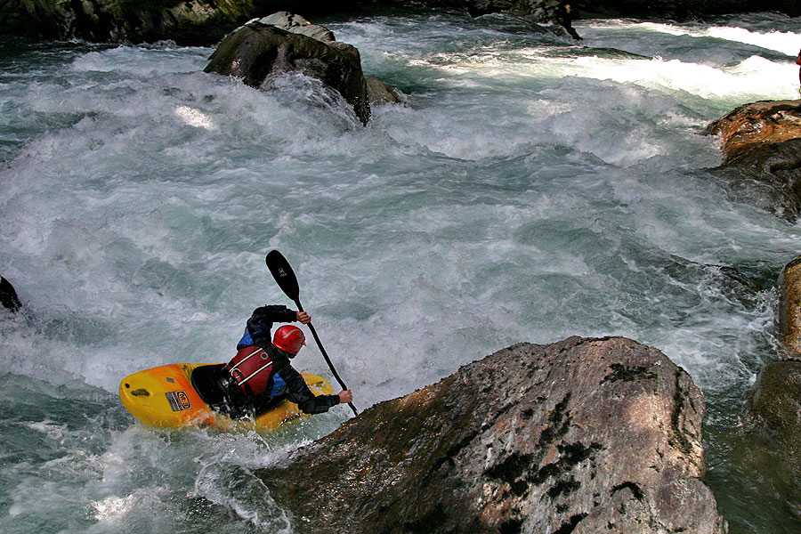
Photo: C.J. Arnold
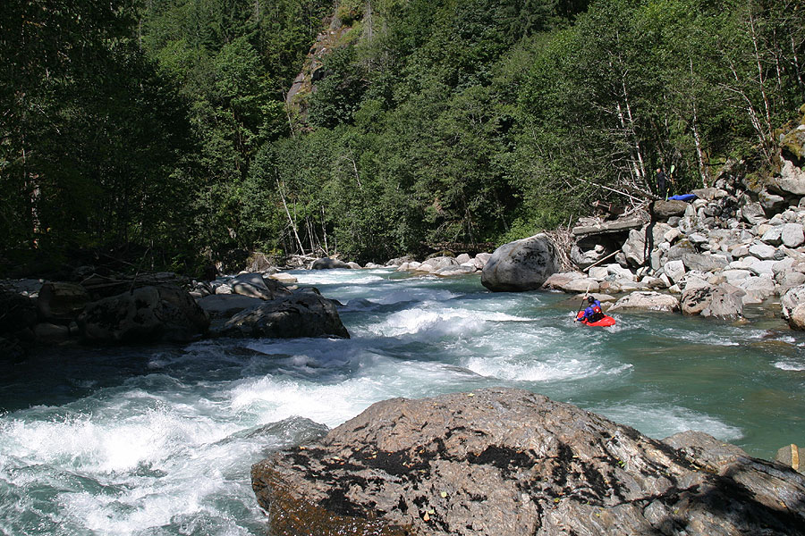
Photo: Ryan Cole
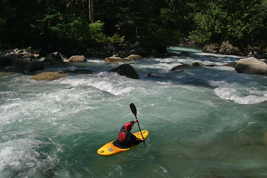
Photo: Ryan Cole
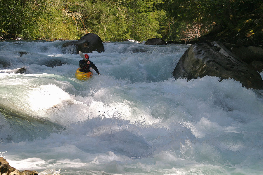
Photo: Ryan Cole
"Just one more Reason."
Photos: C.J. Arnold
Ryan C: "This is better than the Truss."
Photos: C.J. Arnold
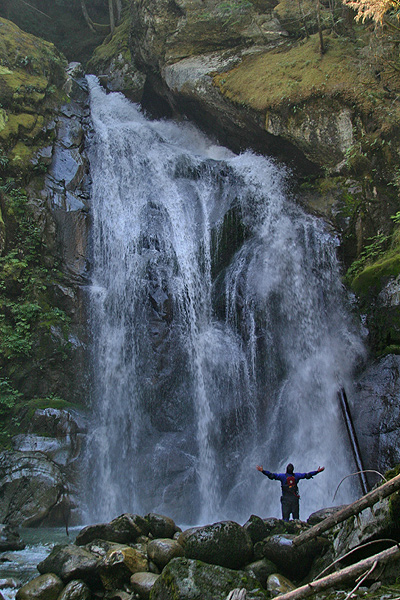
Photo: C.J. Arnold