The canyon run on the upper Deschutes is a wonderful trip for solid class IV paddlers, though you should do this section for the scenery, not the whitewater. That said, this run has some great rapids and a fifteen foot waterfall, but the pools in between these drops are very long and there is a two mile paddle out across the lake at the end of the day. Nevertheless, the flatwater is bearable because there is almost always a current, which allows you to sit back and soak up the magnificent canyon scenery.
This run is dam controlled and usually starts running in October. The best gauge for this section is Pat Welch's Deschutes below Bend gauge. The photos on this report were taken at about 750 cfs on that gauge, which is considered a medium level. Paddlers should be aware that swims in this canyon can be messy as there is thick brush lining the banks almost the whole way down. The brush impinges on the riverbed because for most of the year the river is dewatered for irrigation, and this creates a serious inconvenience for swimmers when the river comes up!
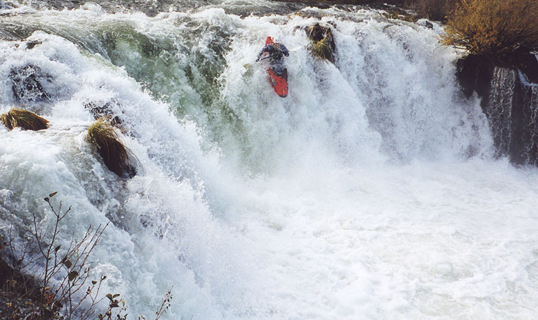
We put in immediately above Steelhead Falls and ran this drop center left. Watch the fold in the middle- if you blunder into it (especially at higher flows) you are in for a heck of a thrashing! Below Steelhead the river is very slow for a couple of miles and you are grateful for the scenery to help pass the time. There are a few small drops here and there, but nothing notable.
Pete Giordano charges over Steelhead Falls.
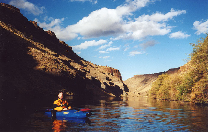
Tom 'international man of mystery' Powers is all smiles as the great scenery helps pass the time below the Falls.
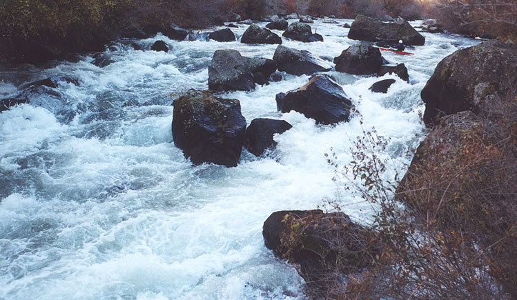
Pete cruises a fun boulder garden in the upper part of the run.
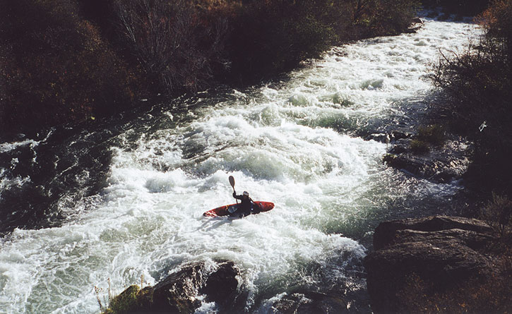
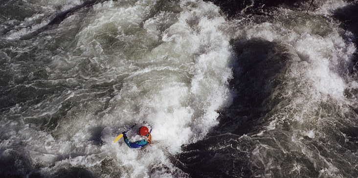
Soon you arrive at Squaw Creek rapid, which is the most difficult rapid on the river (excluding the waterfall). This long drop is signaled by a sharp right turn in the river with the water dividing around a small rocky island in the middle of the river. This rapid is very long (about two hundred yards total) and has a couple of sticky holes waiting at the bottom. The upper part of this drop is mostly fast water and big waves, but as you approach the big rock outcropping on the left catch an eddy on river left and proceed with caution past those bottom holes!
Pete peels out of the eddy just above the rock outcropping at the bottom of Squaw Creek Rapid.
(I was standing on the rock when I took the photo).
Tom punches one of the holes at the bottom of Squaw Creek rapid.
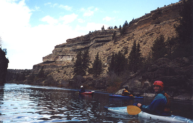
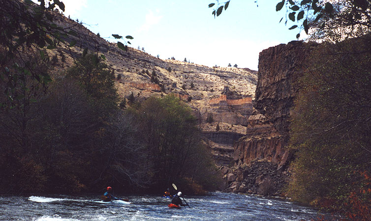
More great canyon scenery...
(Once again, shot from the same rock outcropping where I took the picture of Pete previously)
Shuttle Directions:
The guidebooks shuttle directions make for way too long of a day in my opinion. These alternate put-in directions are taken from my trip notes and and may not be exactly accurate- you should have a Gazetteer for Oregon to help you find the way!
You are looking for a riverside campground on a gravel road just above Steelhead Falls.
From Bend, stay on highway 97 through Redmond and Terrebonne. Just north of Terrebonne turn left on Lower Bridge Road and drive about two miles until you reach NW 43rd. Turn right here and drive north for about three miles until you start to pass a series of small roads turning off at regular intervals to your left. One of these is Badger road. Turn left on Badger, which becomes Blacktail road while you are on it for no apparent reason.
About two miles down Badger/Blacktail the road comes to a T and is now gravel. Turn right here, then drive until you see a small wooden sign for 'River Road' (also a gravel road) turn left on River Road and follow it down to the campground above Steelhead.
Steve Stuckmeyer takes a break during the two mile paddle across the lake.