
"If you make a mistake up there at flows over a foot it's going to turn into a car crash real fast."
-- Longtime Miracle Mile paddler Steve Stuckmeyer
(A note on flows: As on the Little White Salmon, everyone uses the take-out bridge gauge to determine flows for the Miracle Mile; there is no internet gauge for the Miracle Mile, so everyone refers to their trips down at X feet on the take-out bridge. All cfs estimates on this trip report are best guesses based on experience and do not correlate to any internet gauge. I only mention this because I have had people tell me they ran this section at 1200 cfs, which is meaningless for paddlers who know this section. The only valid flow measurement for this run is feet on the bridge gauge.)
At lower flows the difficulty eases considerably and the run is suitable for paddlers who want to get the feel for hard class IV water without the usual commitment inherent in most difficult rivers. The road is always close, and the run is short. For those not interested in paddling class five I would suggest six inches or below on the bridge gauge (~400 cfs and below). I know that lots of folks do this run in the fall and summer at low flows and have a good time, but it becomes a whole different beast at flows over a foot!
I personally enjoy the mile when it is running from 1 to 1.5 feet or 800 to 1200 cfs. At this flow the river offers a high quality class V experience that shouldn't be missed by those capable of doing it. (The photos on this report were taken at 1.5 feet on the bridge gauge in the spring.)
Put in at the 'duck pond', a large eddy a mile above the Christy Creek bridge. This mellow pool is a nice place to stretch and get psyched for the maelstrom waiting for you below! Just downstream from the duck pond is a little class III drop and then a logjam just above the first bridge. Paddle under the jam but watch for the sneaky log extending from the left bank. At flows below a foot this log is exposed and must be boofed.
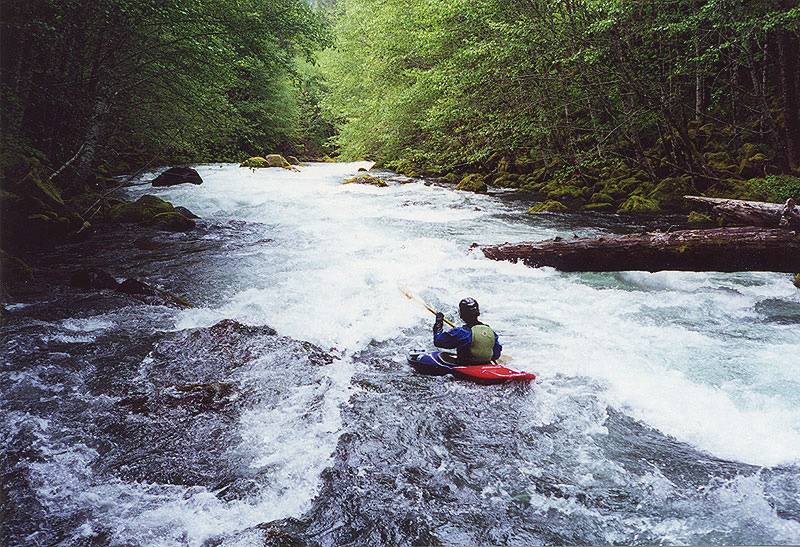
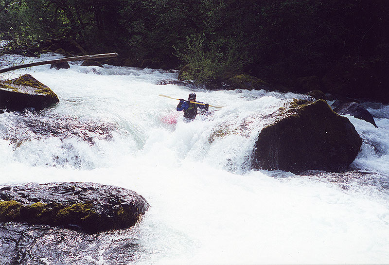
Just downstream of the jam the river bends left and the action begins with Initiation, a long but easy boulder slalom that is a nice introduction to the mile. If you are feeling out of control here you may want to opt for the nature walk because it gets much harder downstream...
Tim dodges the log at the top of Initiation.
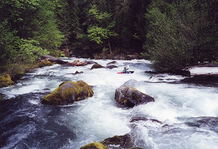
Below Initiation is Ricochet rapid. At Ricochet the river divides around an island. The channel on the right side of the island is full of wood which is fine because most of the water goes left here anyway. Run the left side of the island on the right side of the channel, and beware the big fantail rock in the middle of the drop as it has pin potential. Also, there is currently a log extending out into the current at the top of the left channel, but boofing it is no problem.
Tim squeezes past the pin spot halfway down Ricochet. If you boof the rock in the middle of the river that his left blade is touching you will pin on a second boulder just downstream that the water piles into. This is a perfect line through Ricochet.
Below Ricochet quickly eddy out on the right and get ready for the start of the big stuff at Confusion, a very long, powerful boulder garden. Confusion is the point where most folks who are not up for this run either get a tremendous beating or opt for the nature walk (or both). I won't even try to describe how to run this long, complex rapid... Eddy out and scout on the right. Below Confusion is the biggest eddy on the mile on the river left side.
Tim catches the eddy at the bottom of Confusion.
This rapid is very long, extending up as far as the eye can see and around the corner..
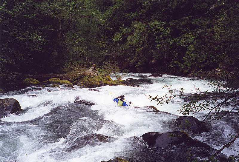
Once through Confusion regroup and get ready for Sharks Tooth. This rapid is pretty nondescript at flows above a foot, but at lower flows I have heard it that is more of a challenge. We usually ferry out of the eddy below Confusion and run the Tooth middle right.
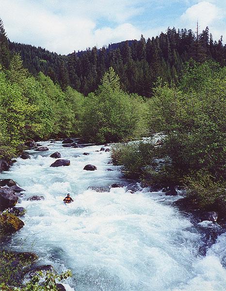
Tim in the run out below Sharks Tooth. This rapid extends as far as you can see in the photo, with the Sharks Tooth barely visible at the top of the photo. The small eddy above Whoop-de-do is visible in the bottom right hand side of the photo. It should be noted that the river has divided just above Tim in the picture- he is in the left channel approaching Whoop-de-do.

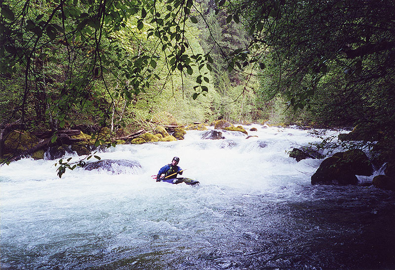
Below Sharks tooth catch a small eddy on river left and scout Whoop-de-do by climbing up out of your boat onto a big log. Whoop-de-do can be intimidating because it requires a must make move in pushy water in order to avoid getting stuffed into a woody sieve on the far river left side. At the top of this drop the river divides around an island- run the left side of the island, right side of the channel. I have heard of boaters sneaking this one on the right side of the island but I have never done it so I don't really know what is over there.
Tim makes the mandatory move to the right at Whoop-de-do to avoid the severely hazardous wood-filled sieve on the left. You can see the other half of the river rejoining below the island just downstream from Tim.
You must come out of Whoop-de-do in control because the river immediately bends left and rips into, around, and over a triangular shaped boulder just downstream. Eddy out on the right and scout, but beware- this drop is harder than it looks. We usually charge the boulder out of the eddy and do a wild sliding boof down the right side, but you can also sneak this drop on the far right. The left side looks clean but it slides into rocks at some flows. One time Tim ran the right side of the boulder down the middle slot and went really deep, doing a cool mystery move into the pool downstream. I don't recommend this line every time because if there was any wood lodged in the slot the powerful current would wrap you around it like silly putty.
Tim runs the Silly Putty Slot.
Once past this rapid paddlers face a long boulder garden that we usually run center left. This one has eddies on the bottom right that set you up nicely for the last drop above the Confluence with Christy Creek.
For all practical purposes the last quarter mile is essentially one rapid which we generally run left to avoid a pin spot on the right. At lower flows there is supposed to be a hidden log down here that has caused a couple of desperate pins, but I have never seen it at a foot and above. The last major rapid begins with a bouldery ledge above the bridge. We usually run the first horizon line right and then generally stay right all the way to the bridge.
The author runs the last rapid as viewed from the take out bridge.
You can see Christy Creek coming into the river on the upper left hand side of the photo.

We use the gauge painted on the bridge at the take out bridge to determine the level on any particular day. I personally prefer flows of a foot (~800 cfs) to a foot and a half (~1200 cfs), but nothing above that. Paddlers do run this section at higher flows ( up to three feet and even higher ) but some of them have been beaten to within an inch of their lives doing so.
In the summertime the mile mellows considerably and though I have never done it at low flows I hear it is a very fun class IV+ run at zero inches on the bridge gauge. The best way to determine flows for this run is to call 937-3852. Take the inflow to Lookout Point Reservoir and subtract the outflow from Hills Creek reservoir and divide by four in the winter and two or three in the late spring. This number tends to slightly understate the actual flow. The wild card here is Christy Creek, which comes in just above the bridge where the gauge is. In late spring this creek tends to have less water, so you have to account for that in the calculation.
Hazards: This entire section is hazardous due to its ultra-continuous nature, dangerous pin spots, and wood. Excellent paddlers have been desperately pinned on this section, so be very, very careful your first few times down until you learn where the nasty bits are.
If you not absolutely sure you are up to it paddle the lower gorge first. Run the last 'big' rapid in the gorge and then imagine tackling three or four that are much bigger and pushier. If that sounds good, you might be ready. Also, the stuff looking upstream from the takeout bridge is much easier than what lies above it. That said, the safest way to do this run the first time ( just like any class V river ) is to go with someone who knows it, especially at flows over a foot.