By Chris Arnold
Section: FR 88 Bridge to Roadside Rapid
Class: III-IV+ ( V-V+ )
Location: Lewis River Drainage
Season: Snowmelt/Rain
Gradient: 107 fpm ( Bennett Guide, pg. 51-52 )
Character: Moderately technical boulder gardens and a few ledge-type pool drops.
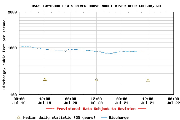
Date: July 20, 2008
Bennett's book recommends a flow between four hundred and nine hundred cfs. The North Fork gauge was reading about nine hundred fifty cfs, but the gauge is located far downstream of this section. At the put-in we all agreed the flow was most likely between four hundred and six hundred cfs.
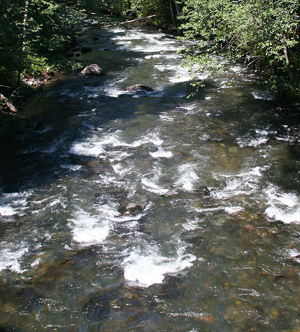
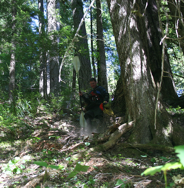
Upper NF Lewis put-in, as viewed from FR 88 Bridge.
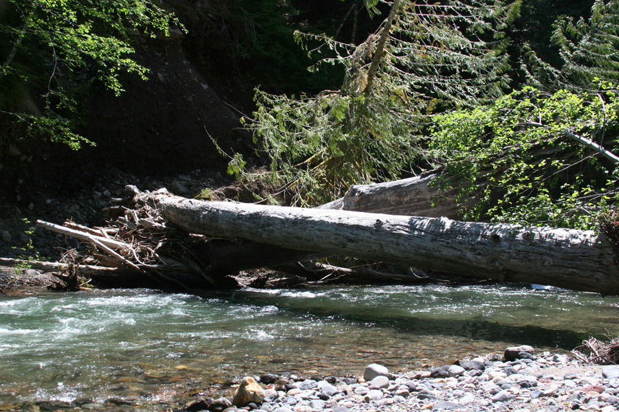
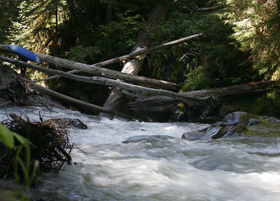
At this level the Upper North Fork Lewis started off fairly slow with a few class three rapids and several easy wood portages. After about three quarters of a mile the action started to pick up. The first significant rapid and entrance to the gorge was just below two old growth logs spanning the river.
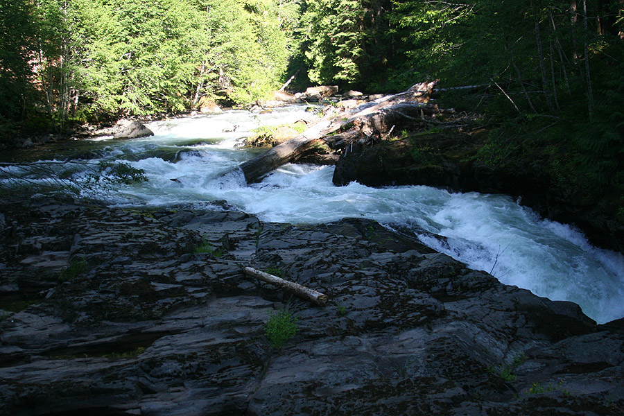
The Gate to the Gorge.
Below the trees marking the entrance to the gorge, the river narrowed and the gradient increased. After scouting we paddled the easy section of class III-IV leading into the gorge. We eddied out on river right just before the canyon walls closed in and I walked several hundred yards downstream to check the tight gorge for wood. After a very close call on the Little Wenatchee that I hold myself responsible for ( two other paddlers almost went under a river-wide strainer ) I always walk around the next corner if I can.
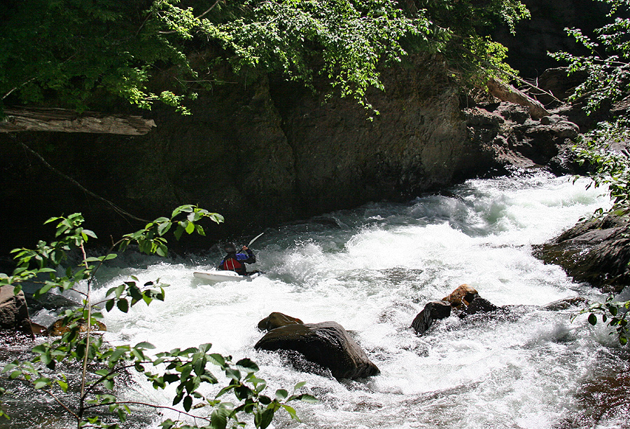
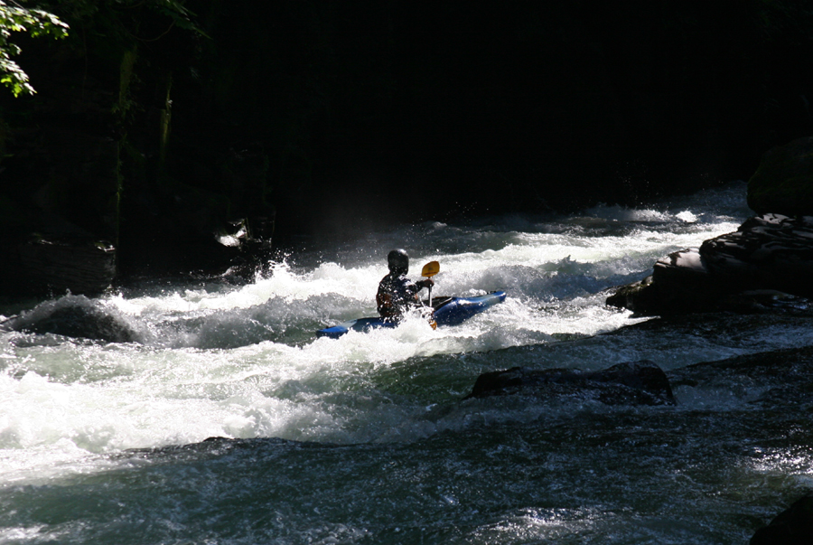
Eric enters the gorge.
Just below where the canyon the walls closed in and the river made a few twists and turns through a tight section and ended with Gunsight: a four-foot ledge drop with a large boulder in the middle dividing the river into two channels. We all opted for the left side as the right side contained wood.
About a quarter mile below Gunsight we came to our first mandatory portage in the gorge. Unfortunately, wood was choking what appeared to be a solid class IV+ ledge type drop. Bennett describes a portage around two unrunnable drops in the gorge. In the absence of wood and at our flow the first one appeared as if it could go.
Portaging in the Gorge.
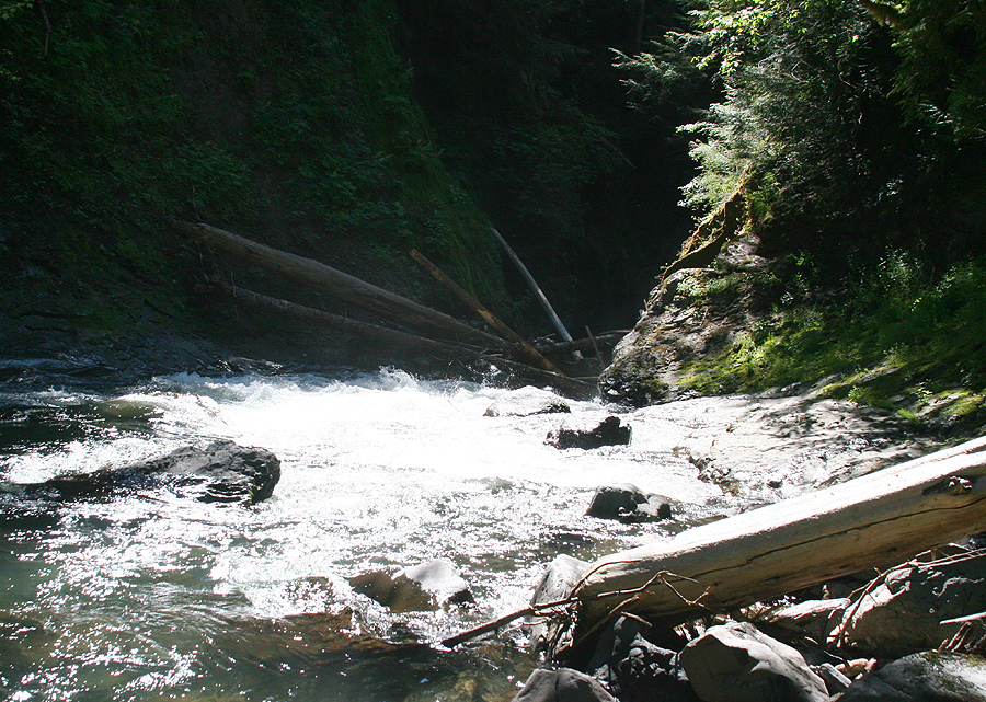
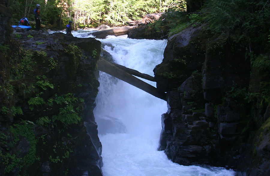
About a hundred yards below the log-choked ledge-drop was the second drop in Bennet's description, a class V+ to VI. Here the entire river dropped over a twelve to fifteen foot ledge into a small cauldron framed by undercut walls with a narrow wood-choked exit. We all opted to walk this one too!
The Class V+ to IV from Upstream.
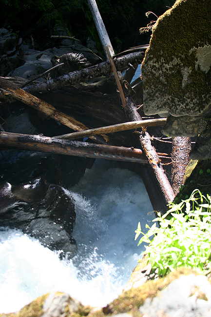
The Outflow of the 'Unrunnable' drop.
We started our hike around the 'unrunnable' drop on river right just downstream of the first portage.
Starting the Ascent around the unrunnable drop.
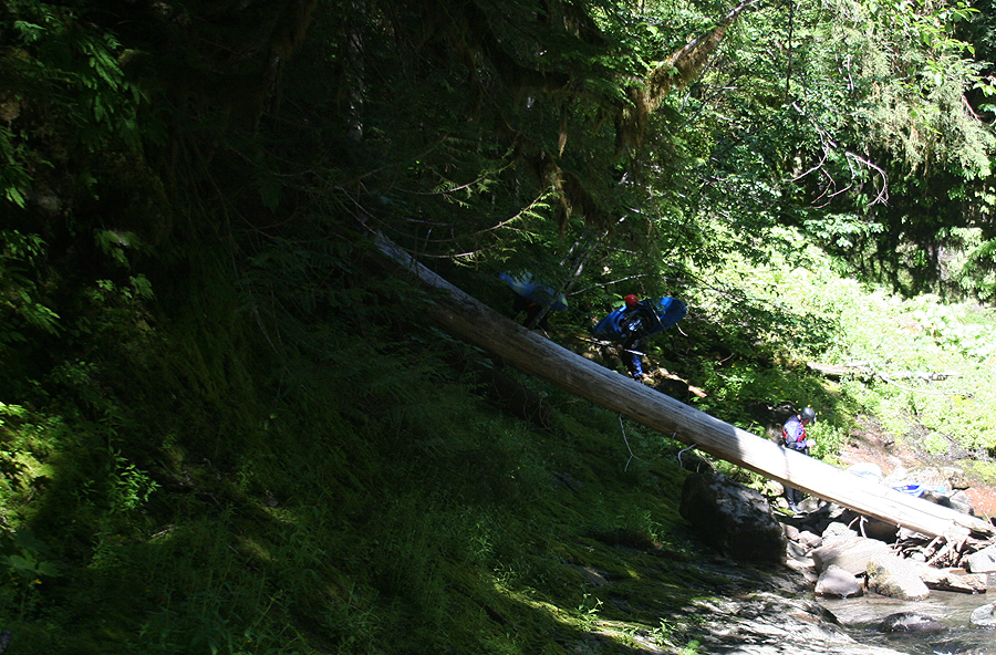
In order to portage we were required to hike up about a hundred feet or so thought relatively thick forest, continue along a ridge for several hundred of feet, and then scramble back down the canyon. We used two seventy-five foot throw bags to lower the boats from one pitch to another one-by-one.
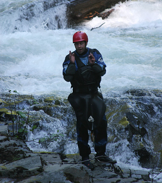
The author, all Smiles, thinking: I can't think of a better way to spend the day."
Photo by Matt Jordan
Below the big portage the river picked up again with several fun ledge-drops and boulder gardens. I think I might have gotten out once to check for wood. There were plenty of eddies and for the most part this section was easy to boat-scout until the next big drop.
When the river took a hard left turn we all eddied out on river right above a pronounced horizon line. Bennett describes a final fifteen-foot waterfall than has yet to be run. Standing at the lip I'm pretty sure it was taller than fifteen feet, maybe more like twenty five to thirty feet. The approach didn't look ideal, but I wouldn't be surprised if someone runs the drop in the near future ( The falls has been run, by Jacob Cruser, see video at the end of the report ).
Last Falls Lead-in
Matt Jordan: "Thin Line.."
Final Falls: Not exactly fifteen feet tall..
After an easy walk around the last big falls we all seal launched back into the river. The last section contained a few good rapids before Roadside. Near the end the river narrowed and featured a longer class IV rapid. It was easy to get out and hike downstream on river right. The bottom of the rapid contained two logs, but both could be snuck on river right.
Nate Bell Below Final Falls.
The last rapid and our take-out was Roadside. It's easy to scout on the way to the put-in. I planned to take pictures while we were running shuttle, but I ate it hiking back down to the river and my camera ended up in a small pool..

This USGS internet gauge shows the flows the day we were on the river, July 20th.
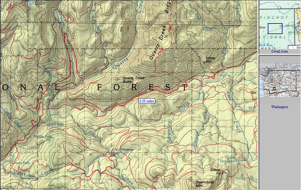
A map of the North Fork Lewis, with the section of the river described in the Bennett guide. We took out upstream of Quartz Creek near Roadside Rapids.
Here is a video sent to me by Jacob Cruser, showing his low-water descent of the Final Falls on the North Fork Lewis.
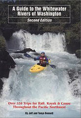
For directions to the put-in and take-out, as well as other info, pick up the second edition of the bible, Jeff Bennetts 'A guide to the Whitewater Rivers of Washington', a book no serious Northwest paddler should be without. You can pick this book up at your local paddling shop, or on amazon.com.