By Jason Rackley
Location: Idaho, River of No Return Wilderness
Class: IV to V-, depending on flows
Gradient: 42 fpm
Length: 58 miles total, 36 on the South Fork, 22 on the Main Salmon
Nature: Ultra-Classic big Idaho mountain river with pool-and-drop rapids. A must-do!
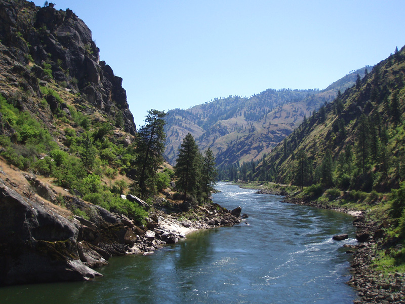
Character: Pristine river flowing big and strong through a wilderness canyon lined with rugged mountain peaks.
Torture Factor: Low until you hit the Main Salmon, then somewhat higher.

Copyright © 2008, Oregon Kayaking.
No part of this page may be reproduced, linked, or copied without the
express written
permission of the Oregon Kayaking webmaster.
The South Fork of the Salmon wilderness section has rightfully earned a place as one of the premiere wilderness multi-day rivers in the United States. Just above the put-in for this run the Secesh River, EFSF Salmon, and the Goat Creek section of the SF Salmon come together to form a river of remarkable beauty and power.

Paddling this river is no simple undertaking, but it is well worth the effort. The shuttle is very, very long ( 109 miles one way, or about four hours ) and if you aren't familiar with the area, allow some extra time for it. There are a few places where civilization intrudes on the run, but for the most part the river is very remote. The run itself consists of thirty six miles of class IV-IV+ ( with some class V at higher flows ) on the South Fork, and twenty-two miles of class I-II on the Main Salmon.
We ran the South Fork section in late June at a flow of 2.99 on the Salmon gauge. It was nearing the end of a two week trip that had been something of a mixed bag due to levels dropping in other areas of the state, so we headed to the more reliable Salmon drainage.
None of us had ever done this section, and the original plan was to have a group of six or so. Of course, as it often happens, there was some group fragmentation for a variety of reasons. Finally we ended up with Robert Bart, Megi Morishita, and myself. Robert ended up putting on a day early because he had to get back to Hood River, so it was Megi and I that ended up putting on.
Paddling the Wilderness run on the South Fork is complicated somewhat by the fact that the South Fork flows into the restricted section of the main Salmon, which requires a day use permit to float. So, the take out is located on the Main Salmon at Vinegar Creek, which is at the distal end of the small road that parallels the Salmon. Grace and David were heading south due to a prior commitment, so they graciously agreed to run our shuttle. This was no small undertaking, so we were very grateful. Of course, we wanted to save them some driving, so we decided to take out at Spring Bar, which is twelve miles further downstream the main Salmon from Vinegar Creek, which meant we had thirty-five miles to paddle on the main Salmon at the end of the trip. This ended up being a mistake, but more on that later.
Driving up the Main Salmon during the mega-shuttle for the South Fork Wilderness run.

The shuttle is, in a word, brutal.. make sure you have a good spare tire and a full tank of gas. That said, the best way to do this section is to make sure you have enough water to paddle the other rivers near the put-in, so you get the most out of such a long shuttle. The East Fork South Fork and the Goat Creek section come together at the put-in for this run and both are worthy, but you need a minimum of 3.5 feet on the Salmon gauge for those to be running ( usually the first two weeks in June are good ).
We put in on Saturday morning, planning on paddling ten miles on the first day. The canyon is very rugged so there aren't a lot of campsites, so you need to plan carefully to ensure you don't end up sleeping on a pile of rocks.
Usually on wilderness runs I go so light that it is ridiculous, packing the absolute bare minimum. However, on this trip I didn't anticipate a lot of super-hard whitewater so I went completely overboard on gear. I packed a full-size tent, extra-large thermarest, a coleman stove, and a ton of food and clothes and all kinds of random crap into my Rocker.
My stern and bow were crammed full ( I even removed my stern pillar ) and my cockpit was filled up completely with gear. Once loaded my boat was so heavy I could barely lift it, but I knew I wouldn't regret it at camp that night. It was going to be like car-camping, in my kayak! This was of course balanced by my lingering doubts about whether I would actually be able to paddle any of the bigger rapids successfully with such a heavy boat.. But, you gotta keep things interesting!
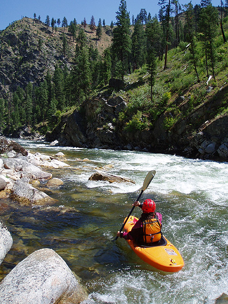
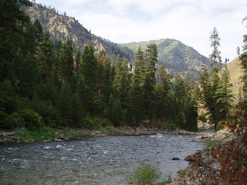
The first few miles were relatively mellow, fun little rapids with some nice scenery. Soon the canyon walls started to rise a bit and the real whitewater started.
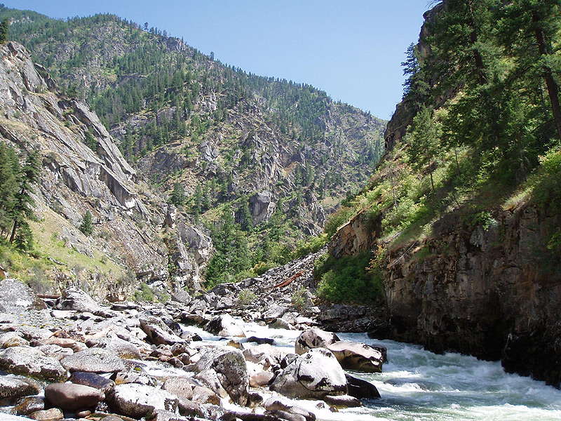
Entering the canyon on the South Fork
The first fun drop I remember swept around a blind left corner with huge holes on the outside of the turn. It was a great ride, and we bombed down it with big smiles! This totally classic rapid would fortunately prove to be the norm, not the exception, on this wonderful river.
There were more fun drops, but that left-corner rapid is the first big one I remember. Of course, we were mostly on the lookout for the first big one, known as 'Devil Creek'. The guidebook says that you can tell this rapid by the creek falling in on the left hand side at mile 8.5. Well, finally we arrived at a rapid with a creek forming a waterfall on the left, and a debate ensued on whether or not this rapid was big enough to be Devil Creek. Finally, we decided it couldn't be because it was too easy.. "There's no way this drop could EVER be called class five.." was Megi's conclusion, which turned out to be correct.
Running the rapid above Devil Creek

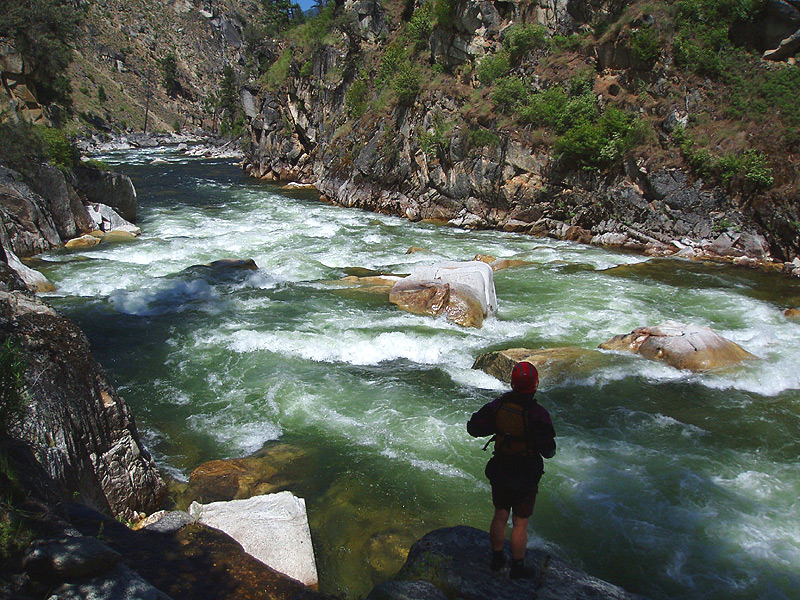
Just below the rapid we thought was Devil Creek we arrived at a very large horizon line, which was definitely the real thing. We got out on the left side to scout, and sure enough, this was the big one.
Scouting the bottom part of Devil Creek rapid. The entrance of this drop is not visible in this photo.
Ordinarily this rapid wouldn't have fazed either of us that much. It was big but there were lines. The problem was that our boats were totally overloaded because of all the extra gear we had brought, so that definitely raised the bar a bit.
The left side of Devils Creek appears to drop into some big holes when you are scouting it. This is true, but we determined later ( after running the drop and viewing the rapid from below ) that lines do exist on the left side, kind of left-middle, near the boulder fence.
Anyway, you can't scout this drop very well, so you have to kind of try and figure it out from upstream and overhead. So, we decided to try to catch the eddy on the left halfway down, then do a big blind airplane turn to the right off of the big boulder in the middle of the river.
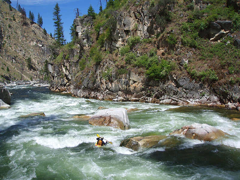
I went first, and was very surprised at how squirrley my massively overloaded boat was as I busted past the big wave hole that guards the entrance to this rapid. I was nearly swept downstream on the left side, but I got er' under control and hit the eddy, but from river level the blind airplane turn move looked huge, but that was the plan and no way to change it now, so I ferried like mad and charged at the boulder..
The author getting his massively overloaded boat back under control after punching the entrance hole.
Notice how low my boat is riding in the water.. Did I mention how comfortable I was in camp that night?
I hit the big pillow and rode high up on the boulder, and for a thrilling moment I was completely perpendicular to the river, and then I was through, into the swirly eddy behind the boulders on the right hand side of the river.
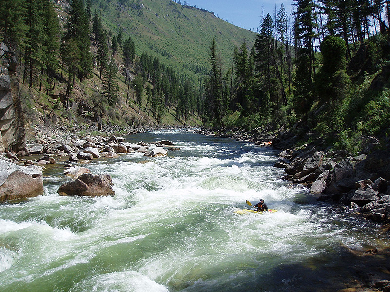
The author running the bottom part of Devil Creek.
Mac came down next with a similar line, no problems, and then we were through and cruising downstream. More fun rapids followed, then we spotted the beach on the right marking ten mile camp, where we stopped for the night.
That evening a large group of Catarafts and Rafts floated by, waving cheerfully. There was plenty of water for the big boats on this trip and I'm sure they had a great time!
The next morning ( and after a very good nights sleep, very much unlike most other kayaking self-support trips I have been on, which are much more minimalist ) I was feeling very smug about packing such a ridiculous amount of gear because I was so comfortable. Of course, that ended when I had to re-pack my boat and after that ordeal I was feeling somewhat less smug.. That took forever, I couldn't figure out how I had gotten everything in there the night before..
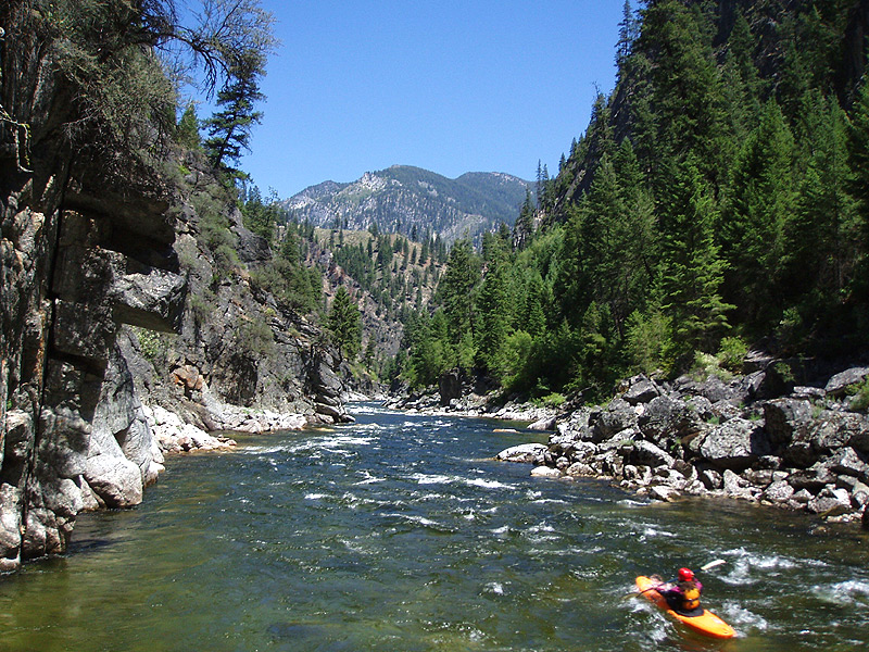
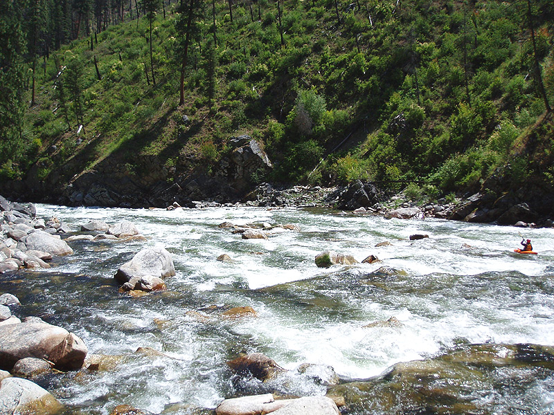
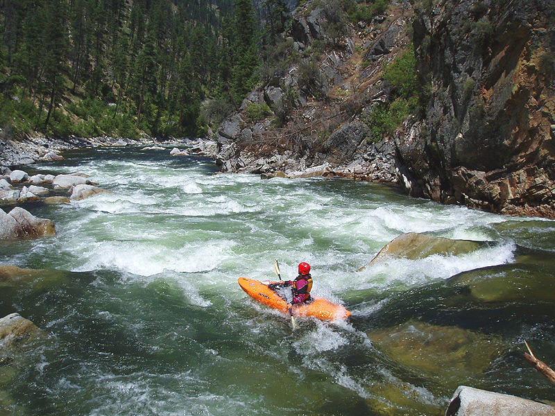
More fun rapids followed downstream of our camp, and the canyon maintained a beautiful, rugged character all the way. Finally we arrived at a large boulder garden which could only be 'Surprise'. At the flow we had this rapid was read and run, lots of big boulders in the channel but nothing too significant in there. I imagine this drop would be very hectic at high water.
Megi probes 'Surprise'.
The river maintained a good pace below Surprise, then mellowed out for a few miles and we sat back and enjoyed the breathtaking scenery.
Eddy hopping below 'Surprise'.
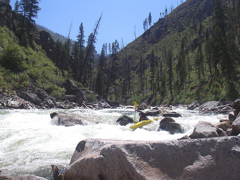
Soon we arrived at the beginning of Elk Creek Rapid, which actually turned out to be the rapid a couple of rapids above Elk Creek rapid. Anyway, we thought it might be Elk Creek, so we got out to scout. We were being more conservative than usual because there were only two of us, and we both had doubts about trying corral boats with so much gear in them if something bad happened. Once again this rapid turned out to be the rapid above the big rapid, but we didn't know that, so we scouted and ran what we thought was Elk Creek..
Megi in the rapid a couple of drops above Elk Creek rapid.
Ok, so after scouting the drop pictured above we decided that probably wasn't Elk Creek. But, downstream was another big horizon line. Perhaps THIS was Elk Creek rapid? Well, no, this ended up being the rapid above Elk Creek rapid. Very confusing.
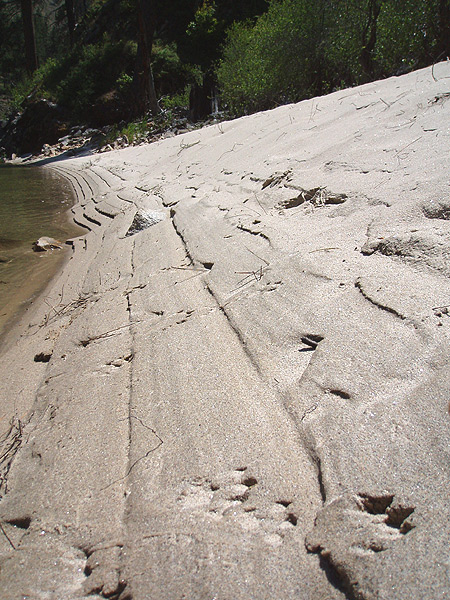
We saw these Bobcat footprints in the sand on the beach when we got out to scout.
Scouting the bottom of the rapid that turned out to be the drop right above Elk Creek Rapid.


While we were scouting the upper part of Elk Creek I looked upstream and saw a flash of orange in the water at the top of the rapid. For a second, my mind didn't process what that meant. I continued to stare at the spot where I had seen the color, and for a few seconds nothing happened.
Then all hell broke loose, because Megi's boat shot out of a hole at the top of the entrance rapid and started running down the left side of the drop. "Your boat! Your boat!!" I yelled, scrambling back upstream as fast as I could. I could hear Megi yelling something but I kept on going.
The author in hot pursuit of Megi's boat in the boulder garden immediately above Elk Creek rapid.
Somehow Megi had the presence of mind to get a photo here.
Back at my boat, into the river, and bombing downstream as fast as I could.
The entrance drop went well, I ran it down the left side and charged through the moving pool below, totally focused on her boat, which was heading towards a big horizon line a hundred yards downstream which looked like it might actually be THE Elk Creek rapid..
Elk Creek ended up testing the limits of my ability to ferry such a ridiculously overloaded boat. However, I also managed to not get any pictures of the actual rapid known as Elk Creek.
I remember I running what turned out to be the lead-in to Elk Creek, a very fun boulder slalom, and then I saw a big cliff-face on the left. The river dropped out of sight around a corner to the right, and I remember thinking about how this might be the actual Elk Creek rapid. Uh oh.. here I go.. I caught an eddy on the left hand side against the wall and peered around the corner where the river was roaring over a large, river-wide horizon line.
It was very loud. I could see the outflow below the horizon line, and Megi's boat in in the middle of the pool, slowing floating downstream towards what appeared to be another ( but thankfully smaller ) rapid.
Hm. So was this the REAL Elk Creek rapid? If so I was facing what had been described in the guide as a 'gauntlet of big holes'. Or, perhaps one big, big hole. I could see that the river was pushing hard against the wall on the left side of the horizon line, so I guessed that the hole was perhaps biggest and most retentive on that side. Sometimes running rivers is about guessing. If you guess right, you have fun. If you guess wrong, you become a human volleyball. Or, in my case, a somewhat bottom-heavy volleyball.
Ok, here goes.. get out to the middle.. But the entire flow was pushing to the left, to the outside of the corner, against the wall.. I came out of the eddy pulling with all I had, I remember that my paddle was bending in my hands, and barely, barely, sort of almost made it out into the middle of the flow, and when I went over the horizon line I remember what appeared to be a wall of white at least forty feet tall ( well, maybe it wasn't quite that tall, it was maybe thirty feet all.. ) Anyway, it was a wall of water that looked quite impenetrable from my river-level perspective. As in most collisions with impenetrable walls, the results were predictable. I stopped. Things got dark, then bright, then dark, then light again. The hole was even louder close-up. Then I was moving downstream and I rolled up, at the bottom of what turned out to be the actual Elk Creek rapid..
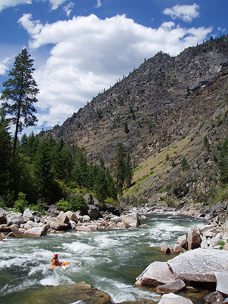
Luckily for Megi her boat got hung up in the class three boulder garden below Elk Creek, and I managed to get it off of a midstream rock after about fifteen minutes of work. Megi eventually managed to work her way downstream, and we were on the river again within an hour.
Below Elk Creek were the first signs of civilization as we passed USFS road 340 and a small bridge. There were actually a fair number of people camping out and swimming in the river here, and we hurried past them downstream and into the unknown. There were more good rapids for the next five or six miles, until we arrived at the other good camping area described in the Western Whitewater book. There is a large field on the left here, with enough room for several groups.
Looking downstream from our camp on the evening of day two.
The next morning I slept in and then we hung out at the campsite, not in any hurry to leave this wonderful place. We ended up eating as much food as possible as well, because we wanted to reduce the weight in our boats.
We had about twelve miles left on the South Fork, followed by thirty-five miles on the Main Salmon ( if you are smart and take out at Vinegar Creek it is only twenty-two miles on the Main Salmon, but we parked at Spring Bar.. not recommended.. )
The canyon was most spectacular on day three. We were now in the River of No Return Wilderness, and the scenery was amazing! At this point the South Fork had risen very high on my list of all-time best all-around multi-day rivers.
Beautiful canyon scenery on day three.
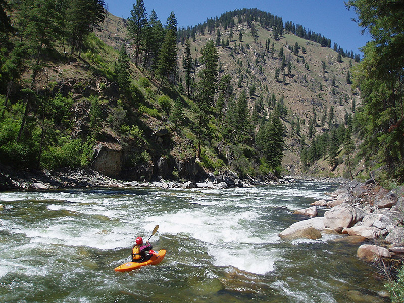
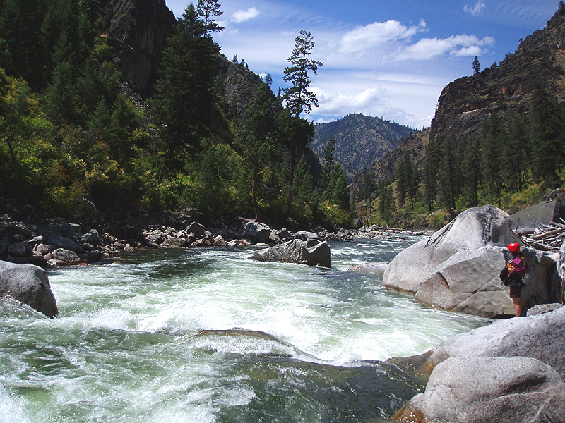
The rapids started immediately below camp with a steep boulder pile we ran down the right. Super fun! The river rolled along below that with lots of high-quality rapids. The whitewater on this river is top notch, clean and fun.
Eventually the canyon walls closed in as we approached the rapid known variously as 'Fall Creek' or 'Triple Falls' or 'List, Lean, and Fall'. We were especially careful above this rapid because it was rated V-VI by the Western Whitewater guide, so we didn't want to blunder into it.
Finally we saw the white 'eyebrow' formation of rock high on the canyon wall on the river-right side and got out to scout. The first drop ended up being pretty straightforward, but the river appeared to drop over something really big just downstream..
Megi probes the lead-in to Fall Creek Rapid.
Below the lead-in was another horizon line and we got out on the right to scout. The boulders forming this rapid were huge, smooth white granite which reminded me of the Feather drainage in California.
The second part of Fall Creek rapid consisted of a ledge with a variety of lines. After scouting we decided to run the spout of water on the river-right side. I went first and had a good deep-water boof, and Megi followed with a similar line.
Scouting the main ledge hole in the second part of Fall Creek rapid.
We ran this down the right side with a deep-water boof.
Below the entrance drop was the third and final part of Fall Creek rapid, which is the biggest rapid on the river. This section is easier at higher water when a sneak opens up on the right. The main line on this drop was very sketchy at this flow because ninety percent of the flow crashed into the left wall halfway down. We couldn't see any way to run the main line with style with our heavy boats, so we opted for the right side sneak.
Looking back up at the final drop in Fall Creek rapid.
The left-side main line is visible in this photo, as well as the right side sneak.
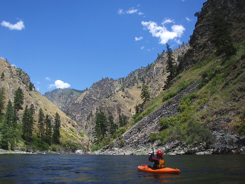
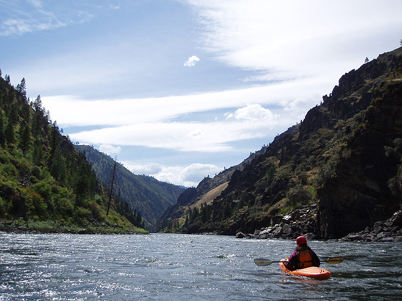
Below Fall Creek the river mellowed and the canyon started to open up as we approached the confluence of the Main Salmon. Hitting the main Salmon wasn't so bad at first, as the buzz of the South Fork was still fresh in our minds.
Paddling out on the main Salmon River. It looked a lot like this for the next 35 miles, unfortunately for us..
After twenty or so miles it started to get dark and our situation started to seem a little dire. Remember that our car was at Spring Creek in order to save our shuttle drivers some miles, but that now seemed like a very bad idea. We made it to Vinegar Creek ( the regular take out ) and kept on cranking downstream through some fun big-water class III rapids on the frequently-run non-permit section of the Main Salmon.
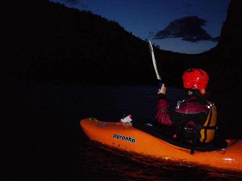
The last two or three miles we paddled in the dark. This was a very intimidating experience as neither of us had run this section of the Salmon, and the river had grown significantly in volume. Luckily there weren't any big rapids, but the wave trains were still an exercise in fear control, wondering if we were going to blunder into a huge hole in the dark..
Four or five hours later.. still not at the take out and running rapids in the darkness, hope there aren't any holes!
Finally I caught a glimpse of silver on the riverbank which could only be Megi's car, and we pulled up on the bank. It was almost ten pm, and we were both exhausted, having paddled the last full day on the SF Salmon plus thirty miles on the main salmon, over forty miles total with heavily loaded boats. We were also starving, because we had run out of food that morning..
Chef Boy-R-Dee Ravioli never tasted so good!!

Recommendations for running this river ( or, how to optimize your trip to the area ):
First, some practical notes. Make sure you have a real spare tire ( not a little doughnut tire ) and that your car is reliable and in good repair before attempting the shuttle. The roads are good quality gravel all the way over the mountains, but if you break down going over the pass it could be a long time before anyone comes along to help you.
We had 2.99 feet on the main online Salmon Gauge. This was a good medium flow for kayaks, rafts, or cat-boats. This river runs very reliably every May-Early July ( but only in July in big snow years ). However, I would recommend a minimum 3.5 feet on the main Salmon for any trip to this area, because below 3.5 you can't run the Goat Creek section and the EFSF, which come together at the put-in for the SF Salmon.
3.5 feet on the main Salmon is the minimum in my opinion because the shuttle is so long that you really, really don't want to run just the SF Salmon Wilderness run once you get to Yellowpine. A better idea is to leave your car at Vinegar Creek on the Main Salmon ( drive up the main Salmon until the road ends, basically ). Then you have several options. If you brought playboats, hit Gold Hole on the main Salmon, which is just downstream from Vinegar Creek. Gold Hole is a pretty incredible playspot! After some time there, bang out the shuttle for the South Fork. That will kill about half a day.
Again, make sure you have a good spare tire by the way because you don't want to break down on the road to Yellowpine. Anyway, drive up through the mountains to Yellowpine ( bottom-right corner of the map below ). Assuming you took my advice and have at least 3.5 feet on the main Salmon, you will be able to run Goat Creek on the SF Salmon, then run the East Fork of the South Fork of the Salmon. Both of these runs are classic Idaho mountain rivers with great rapids! Then on day three, put in on the SF Wilderness run and do it in two or three days. A completely sweet week of boating!
Rating: The classic but out-of-print book "Western Whitewater from the Rockies to the Pacific" rates this river as class V. I think that might be accurate for heavily loaded rafts at high water. For modern kayakers I think this is a class IV-IV+ at the flows we had. Might get to class V in a few spots at really high water though, even for kayaks. You can get a copy of "Western Whitewater" on Amazon.com, or better yet get a copy of Grant Amarals Idaho Whitewater guide ( see below for more info ).
Permit: A day-use permit for the Main Salmon is required to run the South Fork. So, you start on a river where a permit isn't required, and finish on one which does require a permit. Anyway, be sure to allow enough time for the paddle out. Day use permits on the Main Salmon are free and can be acquired ahead of time. Don't even think about trying to sneak on the river; the rangers appeared out of nowhere when we were putting on the South Fork and checked our permits.
The managing agency for the South Fork ( where you get permits ) is located in McCall, phone number: (208) 634-0600. This number comes from the Western Whitewater book and might be outdated. Look on the bottom of the map below, McCall is located about halfway through the shuttle, or you can have the permits mailed to you.
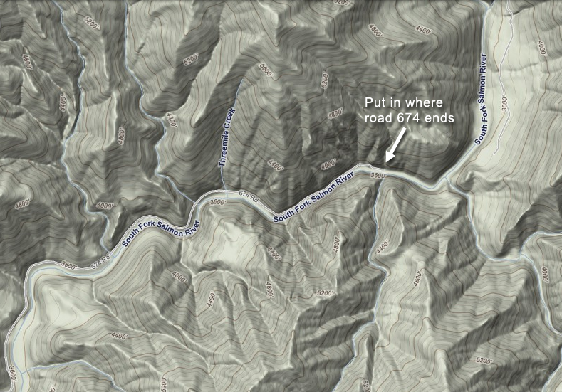
The SF Salmon wilderness run is highlighted in red. The blue line is the 109 mile shuttle. Basically you leave a car at the take-out where the NFD 103 Road ends on the main Salmon, at the top of the map. Park your car at the put-in where the 674 road ends on the SF Salmon.

Zoomed in detail of the put-in on the SF Salmon, at the end of road 674.
For more info, pick up a copy of Grant Amarals guide to Idaho Whitewater, an essential and thorough resource for all paddlers interested in this state. Grants book is Idahos' version of the California 'Bible', and is just as informative and entertaining as the Stanley/Holbeck guide.