The headwaters of the South Fork Umpqua, exploratory trip.
Brad Coleman, EJ Etherington, Gabe Flock, Jason Rackley,
James Bagley Jr, Megi Morishita, Ryan Scott
Torture Factor: None
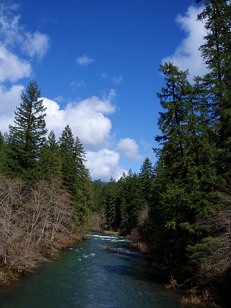
All of the guidebook descriptions for the South Umpqua start at Campbell Falls, so once we passed the trailhead for Campbell we were in unknown territory. As we continued upstream the scenery steadily improved, with walls of trees marching off over the horizon and large rock outcroppings jutting up out of the rugged terrain. Once you leave civilization behind on this river, it starts to feel very wild and remote.
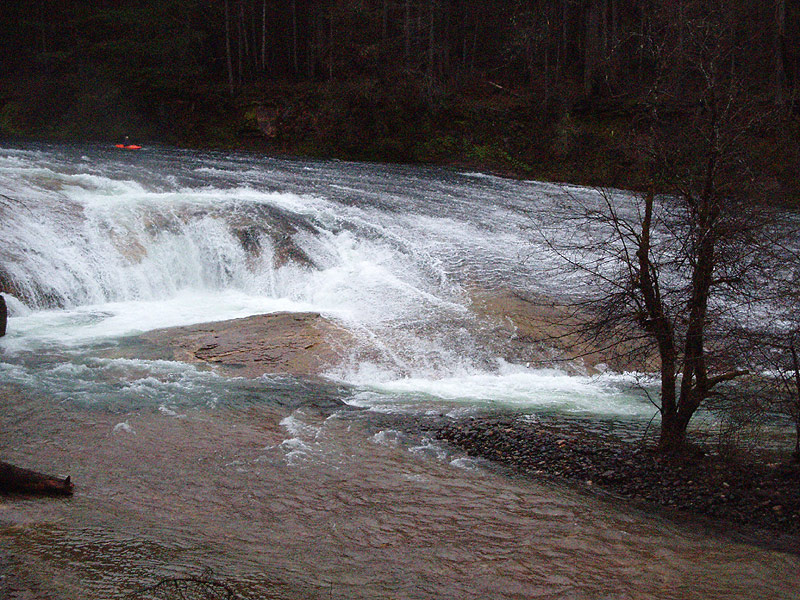
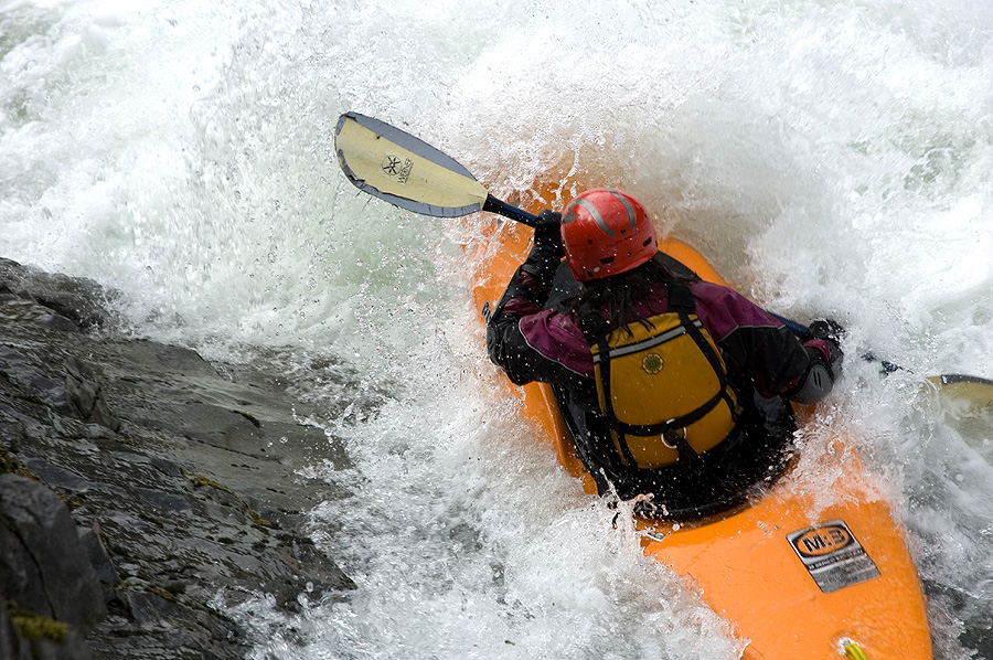
Looking upstream on the Three Falls run. Most of the three falls run looks like this, so bring a playboat.
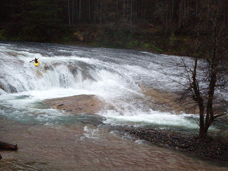
We followed Chads instructions and rolled up on the small parking area adjacent to South Umpqua falls, piled out of the cars, and marveled at the beautiful, dome-shaped waterfall below us.
South Umpqua Falls is straight out of Mexico or one of those other exotic limestone/travertine paddling destinations. The river becomes very wide just above the falls, then rolls down a huge low-angle slide on river-left and drops over a nice plunge on the right.
Everyone decided to run the falls twice: Once over the right-side plunge, and a second time taking the long, sloping magical mystery tour down the river-left side. For magical mystery tour line that we all agreed that more water would be nice, it was a little scrapy over there at the flows we had.
Brad Coleman probes the middle line at the put in drop, South Umpqua Falls.
EJ Etherington takes the magical mystery tour down the huge dome on the left side of South Umpqua Falls.
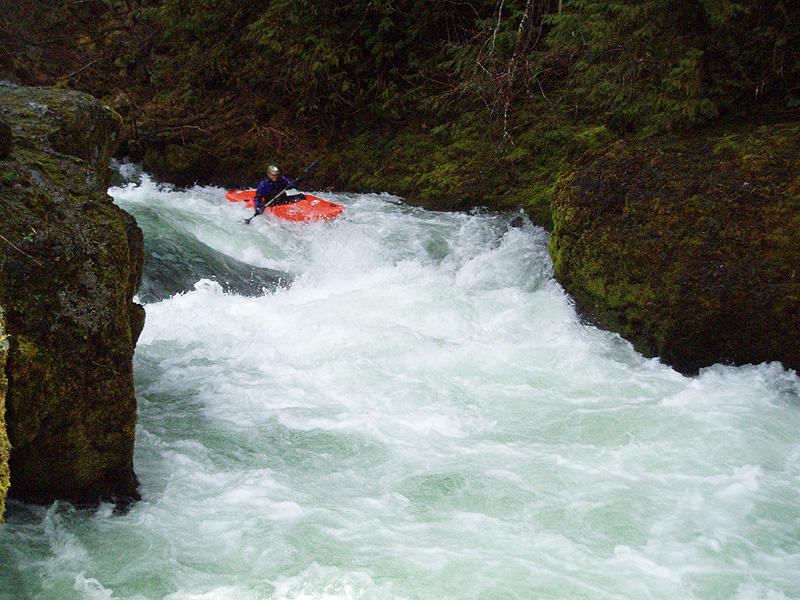
Downstream of South Umpqua Falls the river was pretty flat, class two, for a mile or so. Nice scenery, but no whitewater to speak of. That all changed when we arrived at another horizon line, where the river split around a large bedrock shelf. I hopped out on the center island to scout, and directed everyone through the left channel, a super-fun flume drop that was fun and friendly.
EJ Etherington runs the flume drop.
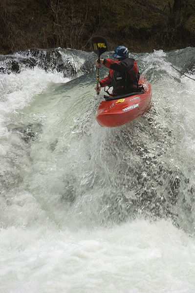
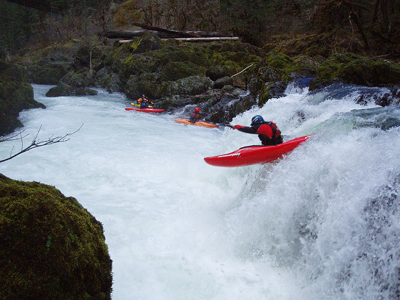
We had a pretty good idea what was downstream of the flume drop because Chad had scouted the river upstream of Campbell falls pretty thoroughly. The next drop is a sloping ledge Chad had named 'The Hand of God' during his scouting missions. We rolled up on a significant horizon line, and everyone got out to scout because Chad had warned us about the hole.
Hand of God is a pretty accurate description of this drop. Here the river rolls over a sloping ledge into one of the worst hydraulics I have ever seen that wasn't man-made. This drop closely resembles a lowhead dam, so no one was even remotely interested in exploring the middle line.
Of course, there is no need to try the middle on this drop, because the far left side of the drop is completely sweet, featuring a long, sloping ramp of water that speeds you down to a launch pad through a big rooster tail of water at the bottom. This drop is easy to run repeatedly, so we all started doing laps, with Ryan getting ten or so runs in if I remember correctly. This drop was soooo much fun, speeding down the ramp and then blasting through the wall of water waiting at the bottom.. Sweet!
James Bagley Jr. probes The Hand of God. The giant death-hole that blocks 90% of the flow is visible here.
James takes flight a second later off the sweet kicker at the bottom..
Megi Morishita runs The Hand of God.
Ryan launches off the roostertail kicker at the bottom of the long, sloping ramp.
Downstream the river became flat and unremarkable again as we drifted into known territory ( All of the guidebook runs for this area start with Campbell Falls, with no information whatsoever about what lies upstream ). We soon arrived at a sharp horizon line, and got out to scout.
Campbell Falls is really clean, with several lines but an obvious boof just left of center. Everyone took this line, with predictable results..
Ryan Scott fires up Campbell falls.
Same photo, from the left side.
We had 1,000 cfs on the South Umpqua at Tiller in March, and we ran this the same weekend that we explored the Black Rock Fork, which lies upstream. 1,000 cfs was probably about as low as you would want to go. We had a week of 60 degree temperatures and some rain leading up to our trip, which helped the flows. The river was actually dropping from a high of 1,500 the previous week.
1,500 or more on the South Umpqua at Tiller is a good flow range. Any lower and it would get too scrapy at South Fork Falls. This run also probably gets some snow on the road in the winter, but I'm not sure about that, or if it gets plowed. I'm also not sure how much of our water was snowmelt, and how much that skews the flows.
Everyone ran this side as well as the middle line..
This drop is essentially a natural low-head dam with only this narrow line over the kicker on the river-left.
Photo by EJ Etherington
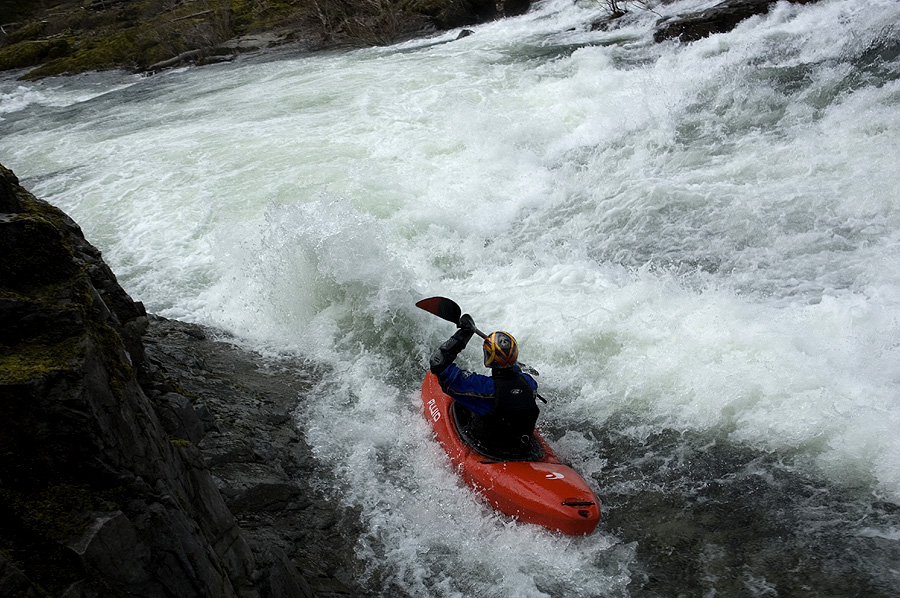
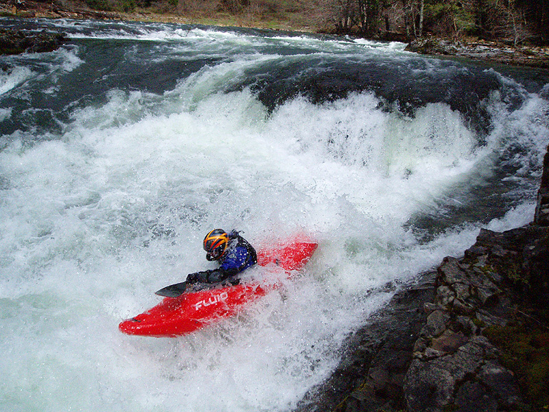
Photo by EJ Etherington
This was one of many laps for Ryan, he ran this drop ten times if I remember correctly..
Photo by EJ Etherington
Photo by EJ Etherington