
In his 'Paddling Oregon' guidebook description Andrew Wulfers likens this section to "A herd of white horses galloping downhill.." This wonderful bit of prose applies to all levels for the Upper East Fork..
The Upper East Fork comes off of the flank of Mount Hood, so the riverbanks are locked in by snow for most of the year. Winter runs are possible for hardy paddlers that don't mind paddling in freezing temperatures, though most usually opt for warmer stuff at lower elevations. Boaters should also bear in mind that the East Fork riverbed can change pretty dramatically after flood events; be sure to scout carefully your first trip down each spring.
I ran the Upper East Fork for the first time in the Spring of 2004. Pete and Marc had been talking about this run but I had never gotten around to it because I had been put off by the guidebook descriptions that made it sound trashy. Needless to say, this river definitely exceeded my expectations and I had a blast my first time down, so much so that Pete and I cranked out a second lap in 50 minutes flat!
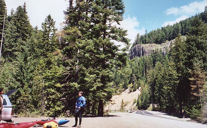
Pete Giordano and Marc Strabic enjoy the great spring weather at the put in for the Upper East Fork
The road runs parallel to the river for most of the run, allowing for easy scouting and a variety of put-in options. On our first lap we put in at Sherwood Campground, but you can also put in just upstream of the Worm (which we did on our second lap) by parking at Pollalie trailhead. Below Sherwood Campground the East Fork is small and creeky, winding along through some mellow class II-III rapids before plunging over a sloping ledge that develops a formidable hole at high water.
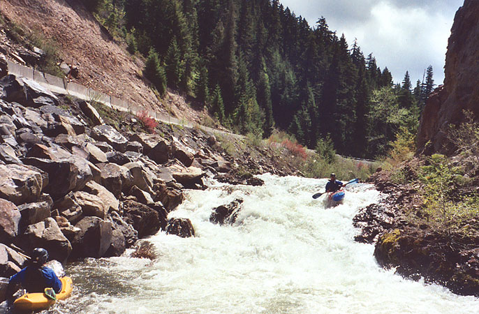
Marc Strabic runs the sloping ledge below the Sherwood put in on the East Fork while Pete Giordano looks on
The steepest section of the river is just downstream of the first bridge and Pollalie trailhead. The action kicks off with a rapid known as 'The Worm' because of the large drainpipe that is sticking out of a flood debris pile on river left. The Worm has cleaned up in recent years and doesn't have the pinning potential found in previous versions, but be sure to hit the holes here with lots of speed..
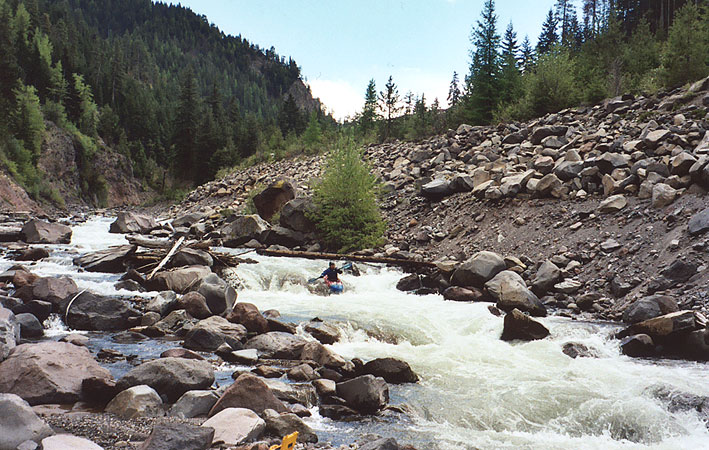
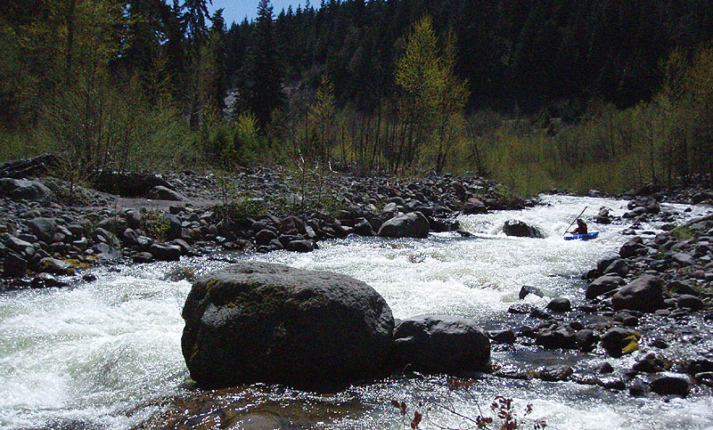
Marc Strabic cruises the fun rapids downstream of The Worm
( The rapid known as 'The Worm' is not visible in this photo )
Downstream of The Worm the river charges downhill with non-stop boulder gardens. The next mile or two are hectic and exciting, with lots of blind drops that can be boat-scouted or bank scouted, depending on your preferences. As I followed Pete down on verbal instructions, I found that the rapids blended together so much it was hard to keep the directions straight. The best option was to just keep Pete in sight and chant the following mantra: "When on the East Fork, do as Pete does.."
Tom Cwiklinski cruises down one of the long, fun slaloms on the East Fork.
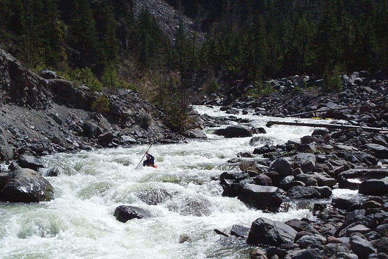
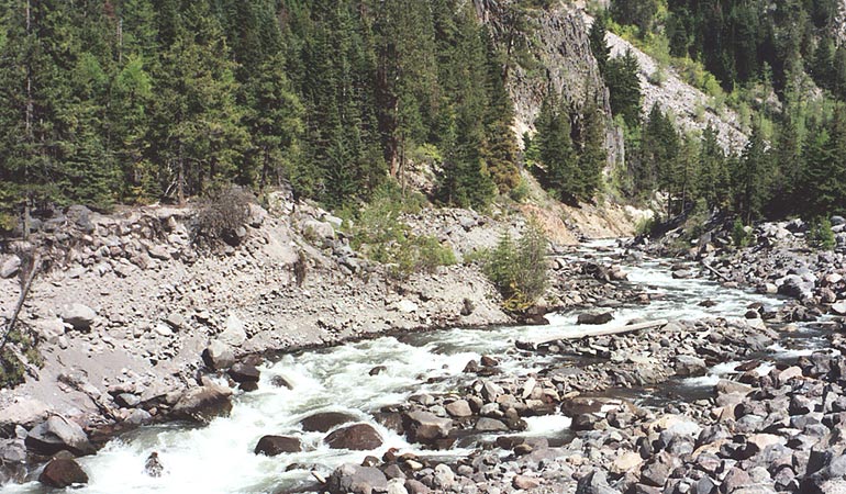
The same rapid pictured above, zoomed out.. The worm is located about 100 yards upstream of the highest visible point in this photo.
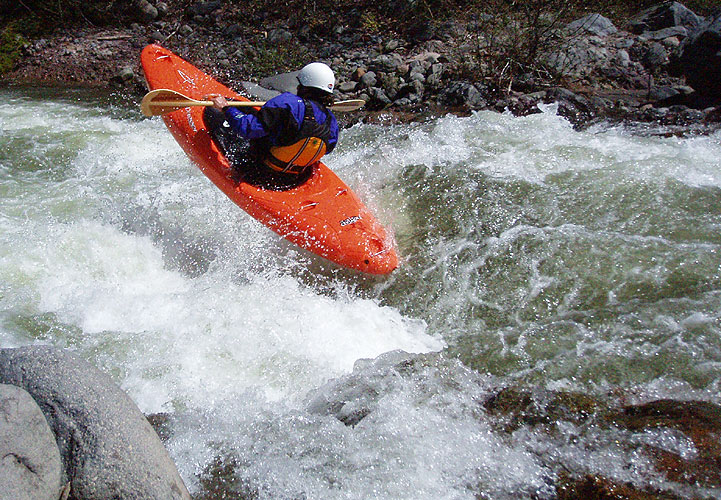
Kenny boofs it up on the East Fork..
After about a mile or two the gradient cools off an the river becomes much more playful with lots of surf waves and holes. The character is still very continuous though, so paddlers not in playboats will still have a nice splashy ride.
Pete Giordano cruises down the easier lower section, the river stays splashy and playful all the way to the take out.
Multiple laps are easy to do on this section because you can put in just above the Worm and drop into the steep stuff right away if you like. Others will opt to put in at Sherwood campground which allows for a better warm up before the bottom drops out.
For shuttle directions, check out the new 4th edition Soggy Sneakers description by Pete Giordano or the Bennett guide's Oregon section.
Flows can be determined on the internet Hood River at Tucker Bridge gauge. Optimal flows range from 5-8 feet. At high water this run is best suited for experienced class five paddlers who have previous knowledge of the river because it becomes a huge 4-mile long rapid with big holes and nonexistent eddies.
You can run this section down as low as 4 feet and still have fun, though it gets a little scrapy at that flow. That said, I think this section between 4-5 feet is probably one of the best training grounds in the state for up-and-coming creekers who want to try something steep with simple escape options and easy scouting. The Upper East Fork has something for everyone!